 “We affect the environment - for better or for worse”
2006 was a big year for environmental issues, both locally and provincially.
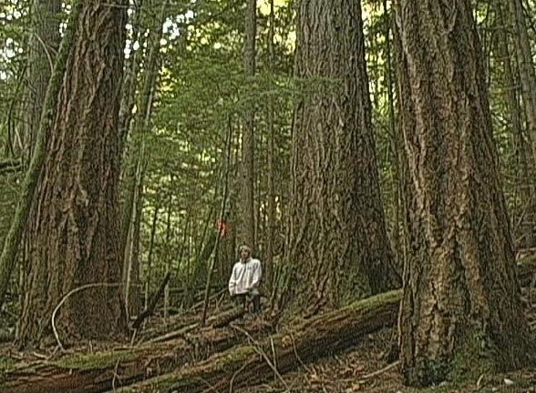
In April Environment Minister Barry Penner announced that his government would not proceed with plans to build a parking lot in Cathedral Grove. Logging along the sensitive Cameron River floodplain has not commenced, neither has the expansion of the park been publicly marked with new signs, and no legislation has been passed to formerly protect this sensitive ecosystem.
The logging of Hamilton Marsh has been put on hold while the RDN negotiates with Island TImberlands (owned by Brookfield formerly Brascan)
A Parksville Qualicum Water Conference entitled “Our Water, Our Future” looked at the local and global issues facing drinking water, a follow-up conference in 2007 will work towards solutions.
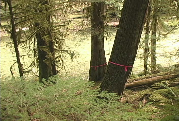
Fisheries and Oceans Canada is responsible for protecting riparian corridors, along the waterways of this region, in order to protect key fish habitat. Timberwest has logged to the banks of the Englishman River across from Morrison Creek and the Salmon Enhancement Canals. Island Timberlands Helicopters have logged the narrow steep banks of the Cameron Rivers, in an area know as Cathedral Canyon. Island Timberlands also plans to log the steep slopes directly above Englishman River Falls Provincial Park.
A private land owner built a house in Squitty Bay provincial park, on Lasqueti Island. After a public outcry Barry Penner, Minister of Environment responsible for BC Parks, gave notice to this squatter and allowed her 6 months to move out. Today the house remains as does the squatter. The BC Liberal government continues to move towards the privatization of BC Parks which will allow private operators to build and charge for services within publicly owned parks. Who will grant these rights and monitor that the parks remain accessible to the public?
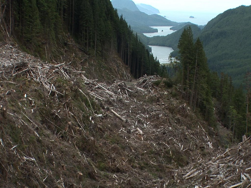
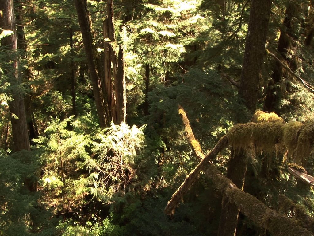
East Creek, Carmanah Valley, and three watersheds in Clayoquot Sound are all that remains of the intact ancient rainforest on Vancouver Island. This year logging began in East Creek and the Clayoquot Sound watersheds, despite the fact that most people believe that these areas are protected by the BC government. Logging licenses on these publicly owned lands have been granted by the BC Ministry of Forests.
The Great Bear Rainforest deal was signed at the beginning of the year and was to protect the largest intact temperate rainforests in the world. A public relations campaign initiated by the BC Liberals has worked to win over BC voters and tourists alike as is evident by the ‘artistically’ painted Spirit Bears found all over Victoria and Vancouver. The reality is that the deal to preserve 1.8 million hectares of land along B.C.'s Central and North Coast is falling apart as Timber companies increase the rate of clear-cut logging to unprecedented levels.
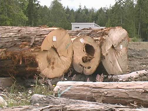
More trees were cut down in 2006 than in any year in the past. Raw Log Exports have increased, the annual allowable cut has increased, and the number of forestry job has been cut dramatically. BC Ministry of Forests sells our trees at extremely low prices to logging companies. Low stumpage fees allow for the price of exported wood to be considerably lower than competitors south of the border. Ironically Timber companies continue to post massive profits. The soft-wood lumber agreement, being signed and negotiated by provincial and federal Forest Ministers, does not include raw logs. The closing of many saw mills through-out BC is directly related to the disagreement and has allowed for the increase in raw log exports.
Fish Farming expansions continue to be approved by the BC government despite evidence that escapee’s, sea lice, excess feed, and contaminants produced by these fish pens are causing the death of wild salmon stocks.
The abundant shellfish found on the beaches around Hartley Bay have been contaminated by diesel fuel that continues to leak from the sunken BC ferry Queen of the North, once again proving that disasters do happen in the coastal waters of BC. The lifting of a federal moratorium on off-shore oil explorations has been a priority for Premier Campbell’s government who plan to have oil rigs and massive oil tankers navigating these same waters regularly.
The United Nations called for a ban on all dragnet fishing. Fisheries and Oceans Canada has thus far ignored this pleas to protect the ocean floors, despite scientific evidence that show that coral and other bottom dwelling organisms provide the basis for the existence of life in the ocean.
Premier Gordon Campbell’s government has said no to wind and solar energy, instead pushing forward plans to build two massive coal burning furnaces and associated open pit mines. Despite the PR spin put on this issue, scientists conclude that coal burning furnaces to generate electrically is the single dirtiest (in terms of pollutants such as NOx, SOx, mercury, etc.) and highest generator of CO2 of any form of power generation.
You may have already had an impact on these issues, or you could help to change them in the future. Individuals do change the world. Let’s make 2007 a HAPPY NEW YEAR!