Friday, August 18, 2006

EAST CREEK ON THE CUTTING BLOCK

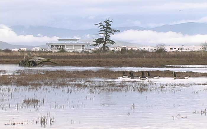
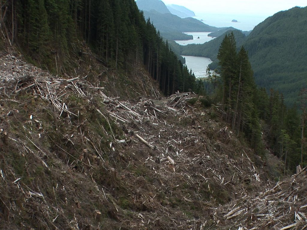
VIEW OF KLASKISH INLET FROM NEW ROAD INTO EAST CREEK

I just returned from a week-long trip into the wilderness on the north-east corner of the island just north of the Brooks Peninsula. My goal was to return to the ancient rainforest of East Creek to begin shooting a film.

East Creek is one of only six watersheds that still remains pristine out of an original ninety-one on Vancouver Island, the other eighty-five have been clear-cut logged. East Creek, Carmanah Valley, and three watersheds in Clayoquot Sound are all that remains of the intact ancient rainforest we know so little about.

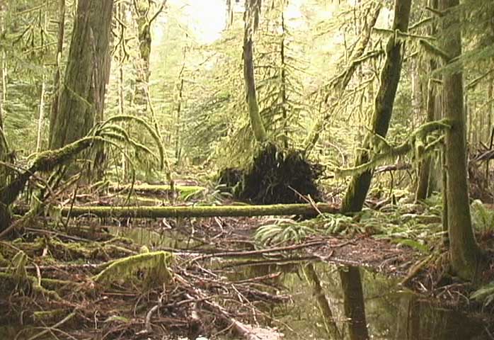
Geographically the primeval rain forest on the shores of East Creek is isolated by rugged mountains, long fjords, a wind-swept coastline with steep, exposed cliffs and thousands of dangerous reefs. The annual rainfall is more than 3500 mm. The rain forest of the Klaskish is at the base of Brooks Peninsula, which held off the glaciers during the last ice age, and is inaccessible by land. The people of the Kwakwala plied these waters for over 10,000 years, moving goods and people between the village sites protected by the many inlets along this rugged coast. The remote and rugged location of this rain forest has protected it from one hundred and fifty years of industrial logging, until today.

I drove a small Subaru station wagon loaded with gear and topped with two 6 meter sea kayaks past the concrete mass of the fume belching pulp mill at Port Alice which was built in 1910. We then drove 75 km of logging road labyrinth through Christmas tree plantations, clear-cuts leveled for the second time for cheap pulp logs, and onto fields of stumps cut from the mountain ridges right down to the ocean’s edge.

As soon as we had crossed a bridge over Klaskish Creek the logging road began a series of steep switchbacks where, according to my topographical map the road into East Creek rises nine hundred meters over one kilometer. This extreme road winds through clear-cuts on Crown land in what is designated as sensitive management by the BC Ministry of Forests. Suddenly the entire road ahead was filled by a fully loaded off-road logging truck roaring towards us with 100 tons of enormous ancient logs stacked twice as high as the truck. Luckily I was able to pull off where a grader had widened the road. It was truly heartbreaking to see this massive truck drive past us loaded with 1000-year-old yellow and red cedar from the highlands of the East Creek valley.

Unable to drive up the steep logging road we decided to try accessing the ancient rainforest of East Creek by paddling our kayaks to the mouth of the Klaskino Inlet and then along the open coast for 8 km in the Pacific Ocean. Amongst the rocky reefs and associated kelp beds we watched several Sea Otters swimming, diving, and squealing in their high pitched tones. Through binoculars I gazed at an adult smashing a Sea Urchin with a stone and a tiny young pup scrambling onto her belly to eat the tasty treat.

We camped on a well protected sand beach at Heater Point. The next morning we hiked out to the open coastline of the Pacific Ocean to check out the surf. We watched waves pound into the steep granite cliffs of the rugged coast dotted with offshore rocks. For the next three days the coast guard weather report called for gale force winds in Brooks Bay.

We paddled back the way we had come, stopping at an ancient village site standing alone in the midst of massive clear cuts which have devastated most of the shores of Klaskino Inlet. We marveled that the five foot deep midden along the shore and ventured into the tiny stand of old growth forest where we looked at examples of trees that were Culturally Modified several hundred years ago for a variety of uses by First Nations. Massive planks split off living Cedar trees which continue to grow, Sitka Spruce with massive holes burnt into them so that pitch could be harvested, totem and canoe trees left behind due to splitting.

On the way back we sighted ten bears, several of them cute and very curious cubs, foraging below the tide line. All the while we paddled closer to the extreme logging road over the ridge into East Creek through piles of debris, exposing blasted rock, and scares created by landslides. BC Forest Minister Rich Coleman FOR.Minister@gov.bc.ca

Wednesday, May 03, 2006

CANYON GEM HIDES ANCIENT FOREST

There is a jewel hidden at the base of Mt. Arrowsmith. A place so secluded that most people do not know that it exists. Since the last ice age the flow of water known as the Cameron River has cut a deep canyon through the stone ridge many know as ‘the Hump.’ The Cameron Canyon reaches a depth of 250 meters and runs for 6 kilometers between the Cameron logging road mainline and the Alberni Highway at the base of the hump.

Last week-end I left behind the massive clear-cut and single species tree farm that makes up the Cameron Valley, with the exception of the old-growth trees of Cathedral Grove, and hiked down into the Cameron Canyon. I should say I clambered, scaled, and climbed between the sheer rock faces by skirting along the moss covered rock-slides which had fallen off the sides of Mt. Arrowsmith.

I started my descent into the Canyon down the east face. The forest showed signs of a forest fire approximately 200 years ago which had opened the forest canopy to allow the growth of many tall, slender western red cedar and western hemlock trees. Moss and lichens covered almost every surface in this dense forest. Colours blended into one another, yellow green over the rocks, gray and green hanging from the trees, with spatters of red or orange created by lichens in bloom. Despite the rugged location this dense forest is so lush that any open spaces are covered with ferns, Salal, and Salmon berry.

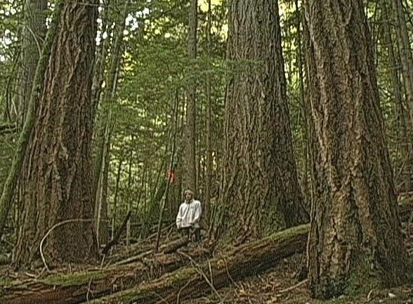
Between the dense growth of younger trees, most over 150 years old, I came upon the occasional massive old-growth Douglas Fir. Remnant survivors of the fire, the thick bark of these trees had protected these fir trees for six to eight hundred years.

Then I saw the first freshly cut stump. I lost count of the rings at six hundred and forty because the growth was so slight towards the outer edge that I could not distinguish between the years. I later counted thirty stumps and twenty more old growth trees marked for logging by Island Timberlands on the east side of this steep canyon.

The next day I hiked/climbed down the west face of the Cameron Canyon, where the ‘hump’ falls off into the deep ravine. Steep cliffs are topped by a series of clear-cuts and tree farms ranging in age from 50 years to this winter when Island Timberlands cut down the last of the big trees. I skirted an almost vertical drop down to the Cameron River where I found a very narrow floodplain with rick soil and massive Cedar Trees.

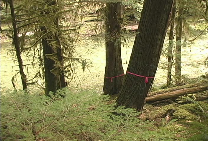
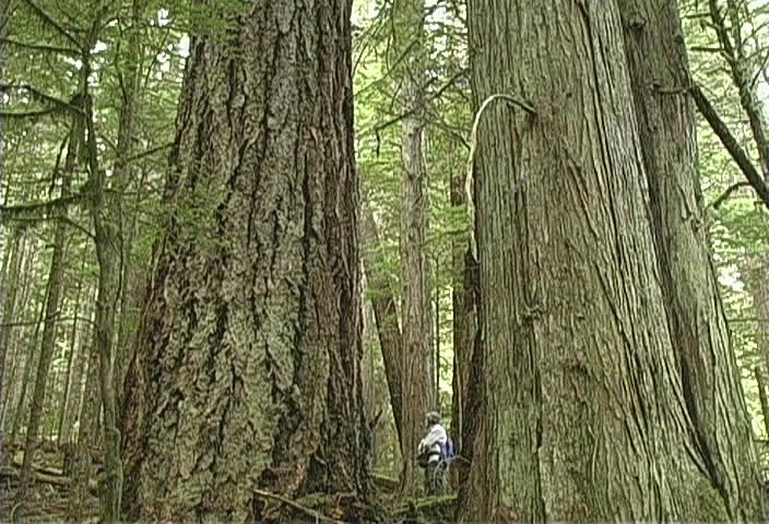
Both sides of the river are lined with some of the finest specimens of Western Red Cedar that I have seen in my entire life. They are about two meters in diameter, straight with no spiral, clear with few limbs until the top which reach heights of sixty to eighty meters. The forest floor is covered in moss, lichen, ferns, salmon berry, and devil’s club. Most of the big trees, some growing directly out of the river’s bank, are ribboned and spray-painted for logging by Island Timberlands.

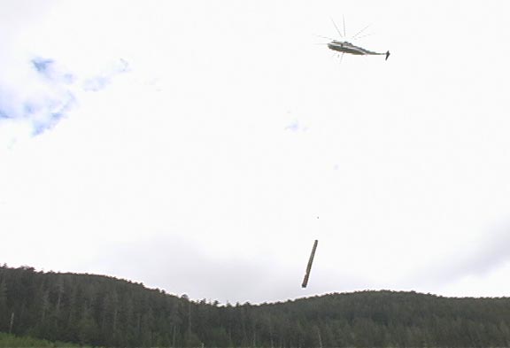
Single stem heli-logging involves a faller climbing the tree while cutting off any branches and then the top of the tree with a chainsaw. He then climbs down and cuts the tree from both directions with no wedge cut until there is only a very narrow piece of wood holding the tree. Then he runs for cover as a helicopter grabs the top of the tree with a claw, snaps off the tree trunk, and flies away with the log.

Is it any wonder that more fallers are killed every year than any other occupation in BC? This type of logging allows access into the places that have never before been logged and trees are being cut down in the most fragile and sensitive locations. This is not sustainable. After all, how long does it take to grow an eight hundred year old tree? The Cameron Canyon needs to be protected not logged.

For details contact: Jim Sears, Island Timberlands 468-6810

Let the Federal Department of Oceans and Fisheries know that this type of logging on river banks is not acceptable by writing to Minister Loyola Hearn at Min@dfo-mpo.gc.ca

Friday, April 21, 2006

WATER BRINGS PEOPLE TOGETHER

For the third time in as many weeks more than a hundred people rallied on ‘the hump’ of Mt. Arrowmith in order to stop dozens of fully loaded logging trucks that leave the Alberni Valley every five minutes. Mill workers, log scalers, environmentalists, union reps, the Mayor of Port Alberni, the local MLA, along with citizens from Parksville, Qualicum, Port Alberni, and other parts of the Island were all speaking the same language. They have had enough of massive corporations reaping all the profits and leaving the local communities without resources, long term benefits, or the essential ingredients of life such as clean drinking water.

In Alberni mills have shut down, the entire Sprout Lake division has been shut down, and the Franklin division has been reduced from 500 to 100 employees due to raw log exports and mechanization. TimberWest recently logged the watershed forests that feeds into Beaver Creek causing massive erosion and mudslides that have directly impacted local residents who have had to suffer no less that four boil water restrictions in the past few months.

The situation in Oceanside is much like that of the Alberni Valley. Englishman River and the Little Qualicum River provide drinking water for the residents of Parksville and Qualicum as well as several outlying communities. The forests that provide the watersheds that feed into these rivers are being heavily logged by both TimberWest and Island Timberlands (formerly BRASCAN renamed BROOKFIELD)

In a symbolic gesture of respect Island Timberlands and TimberWest allowed their logging trucks to be stopped briefly at the brake check on ‘the hump’ before moving on to log sorts in Nanoose and Crofton. Jim Sears, manager for Island Timberlands, refused to speak with me while he monitored the situation and made sure that the logging trucks kept rolling past the people.

A cougar hunter was much more talkative, and explained that he walked the ridge from the hump to Cathedral Grove every morning with his dogs. A few days earlier he had come upon a survey crew that was plotting a logging road for Island Timberlands from Loon Lake across the slope above Cathedral Grove. The plan is to log the entire ridge, which is primarily old growth forest, including heli-logging the giant trees adjacent to the provincial park that grow between the highway and the railway.

When I mentioned this to BC Parks manager Chris Kissenger he claimed that he knew nothing of logging plans along the park boundaries. The Master plan for the Provincial park states; “BC Parks BC will ensure its goals are met by: working with adjacent landowners to ensure compatible land use decisions which consider the park as an integral park of a larger land area setting.” When Island Timberlands logs the ridge above Cathedral Grove the wind tunnel effects alone will dramatically effect the trees inside the park through ‘edge effect’ and ‘blowdowns.’

Down in the valley a camp that was built over the course of 26 months was dismantled in a matter of days and the sensitive forest was returned to the same condition as it was five years ago when public protests began. The citizens who protected this delicate ecosystem from being destroyed removed all signs of their presence as a sign of good faith towards an announcement made in the legislature by the Honourable Minister for the Environment Barry Penner who said; “At this point, I can inform members of the house and the public that B.C. Parks does not have any intentions at this point of proceeding with the new parking lot option at Cathedral Grove.”

Despite the fact that Minister Penner said “at this point” twice, the onus now lies firmly upon the BC government to work with the public towards an alternative solution in Cathedral Grove. The environment is not safe until the status of a class “A” park is extended to the 21 hectares currently zoned as a recreation area in order to allow for logging, road building, and bulldozing. Scott Fraser, MLA for Alberni-Qualicum, will raise this issue in the legislature and the public will hold the government to its word.

Friday, February 24, 2006

COASTAL DOUGLAS FIR ENDANGERED

Most of us living in Oceanside know what a Douglas-fir looks like, after all they are the most common tree species found in this area.Trees support entire plant communities, and only mature trees provide the complexity needed for the full range and diversity of plants. The simple fact is that these massive trees were strong, abundant, close to the sea, and therefore they were logged to the brink of extinction along with the vegetation they support. As a result the Douglas-fir/Salal and Douglas-fir/Sword Fern are both red listed as rare and endangered plant communities on Vancouver Island.

The British Columbia Ministry of Forests references forest types by designating them into specific biogeoclimatic zone. Identification is base on three points of reference: “Bio” indicates the biological nature of the ecosystem based on the vegetation, “Geo” indicates the use of soils and geology, and “climatic” refers to the climate. The entire province has been classified into 14 biogeoclimatic zones. This system should not be confused with the scientific identification of all ecosystem in British Columbia because these terms have been established by foresters, working for the BC government, who are primarily interested in identification of trees for logging by private corporations.

The Coastal Douglas-fir biogeoclimatic zone is limited to a very small region of BC. A thin strip along the east coast of Vancouver Island from Deep Bay south to Victoria, several of the Gulf Islands, and small patches around Powell River and the Sunshine Coast. The rest of Vancouver Island is designated as Coastal Western Hemlock or Mountain Hemlock. These forests are completely different with regard to tree types, ground cover, and most notable moisture. The most extreme rainfall is found along the north west coast of the Island where the annual average is 4.5 meters according to statistics Canada. The Oceanside area, being in the rain shadow of the Vancouver Island Mountain Range, is usually much dryer with annual rainfall less than 1 meter. Most of Vancouver Island maintains some moisture through the summer with early morning fog that rolls in off the Pacific and the occasional rainfall but in the Coastal Douglas-fir zone there are long periods of drought .

Take a look around at the limited number of old-growth Douglas Fir trees in Oceanside and you will likely notice that the bark is blacken like charcoal. Older Douglas-fir are able to survive fires because they have very thick bark which helps to protect them from the heat and flames. Thin barked trees such as cedar, hemlock and most deciduous trees burnt to the ground in naturally occurring fires during past centuries. The cones from Douglas-fir that remained standing in a blackened and charred landscape would colonize the surrounding area which was devoid of competition. It would take many millenia for the process of succession to allow shade tolerant trees like hemlock and cedar to become dominant. Then fire would start the process over again leaving only a few remnant Douglas-fir giants as seed trees.

With the exception of a few remnant old-growth Douglas-fir, most of the trees that surround us in Oceanside are in the very early stages of their lives, anywhere from seedlings to 80 years old. Considering that a Douglas-fir reaches it climax at approximately 800 to 1000 year, then the trees around here are not even ready to attend kindergarten. The Coastal Douglas-fir zone is one of the smallest of British Columbia’s 14 biogeoclimatic zones yet it contains some of the province’s rarest vegetation with a diversity of ecosystems that is unparalleled. This fragile environment is seriously threatened by continuing human development.

The rest of BC has 12% of the land base set aside as protected and/or park thanks to the hard work of many dedicated citizens who convinced the NDP government of the 1990s that this was a priority. Granted much of this land is mountain tops, rock, and ice but it far exceeds the protection for land on Vancouver Island. Please write to Gordon Campbell and let him know that 6% forest protection is NOT ENOUGH for Vancouver Island! premier@gov.bc.ca The BC Liberals require that you include your full mailing address so they know you are a voter.

Friday, February 10, 2006

GREAT BEAR RAINFOREST CHANGES THE GAME

Several times a day for the past week I have found myself jumping up with joy to shout that the Great Bear Rainforest (GBR) has been protected, then I sit back down and remember all of the practical implications. A lot has changed over the past 15 years when the social-environmental struggle was dubbed ‘the war in the woods’ by the media. The struggle of the people to protect the environment of this planet has changed, as have the rules, lets hope the results change too.

1.8 million hectares of land along B.C.'s Central and North Coast will be preserved to protect the largest intact temperate rainforests in the world. The GBR is home to the Kermode or "Spirit" bear, a rare, white variation of the black bear as well as one of the world's last large populations of grizzly bears.

This initiative was spearheaded by First Nations and environmentalists who have been in negotiations for the past 10 years with the forest industry and the BC government. After large well organized public protests at Clayoquot Sound the government and multinational logging corporations refused to attend the negotiations for the GBR until environmental groups signed onto a list of very stringent rules. The non-profit groups agreed that they would not make demands for land protection anywhere else in the province or the other parties would walk away from the GBR table forever. This meant no lobbying for public support, no public relations campaigns, no advertising, no boycotts, no rallies, and definitely no roadblocks. As a result the groups with the largest public support, best organizational skills, and the biggest political clout did nothing about the many atrocities being perpetrated upon the environment in British Columbia. All the eggs were in one basket, the Great Bear Rainforest.

Limited’ logging will be allowed in the GBR under the new land-use plan. I have heard the words limited, selective, and special management used by foresters to describe their methods of logging. I have seen what the BC Ministry of Forests allows logging companies to do out in the wilderness. Variable retention logging is flaunted as being different from clear-cutting. I have witnessed ‘new age’ logging that goes on today in some the most sensitive forests, managed under strict government supervision. The results include: steep slopes with all the trees cut down except a few left on the top of the ridge to blow down in the first winter, river banks exposed by log-yarding and road building that forces silt into Salmon bearing streams, patches of trees left as wildlife corridors that blow down and are then ‘salvaged’ a few years later, and devastation beyond the imagination left behind in the ‘unclear-cuts.’

Today, with the change from the Forest Practices Code to the Results Based Code implemented by the BC Liberal government, logging corporations are expected to monitor their own adherence to environmental policies.

Environmental organizations will contribute $60 million in the hope of changing the economic focus of communities located around the GBR, from resource extraction to eco-tourism. The province will add $30 million and ask Ottawa to match it. This financial shift is very significant because it means that nonprofit organizations will be paying half the cost while tax-payers take the back seat in the preservation of parks. The question is who will set the rules? For example the rules of protection have been modified repeatedly in Strathcona, established in 1911 as the first BC Provincial Park, when government allowed mines, logging, road building, private resorts, and dams to alter the environment inside the park.

At the end of last year, environmentalists spent $1.35 million to buy the trophy-hunting rights in an area now known as the Khutzeymateen Grizzly Sanctuary. The most valuable guide outfitting territories in B.C. transformed into eco-tourism overnight. Foreign hunters are no longer welcome to shoot bears and wolves in a 20,000 square kilometre area of B.C.'s Central Coast, they are now encouraged to bring cameras instead. Sounds great, but in the GBR all BC residents with a regular hunting license can still shoot bears, wolves, cougar, deer, moose, elk, grouse, ducks, and just about any creature they like within the proper hunting season. This is also the sad fact in most provincial parks in BC.

Today I rejoice that a significant park has been established. This may mean that I can see a white black bear someday. I also know that all those places that have been left out of these negotiations are still worth fighting for and must be protected. On Vancouver Island: Cathedral Grove, East Creek, Upper Walbran Valley, Little Qualicum Floodplain, Hamilton Marsh, and the Nahmint Douglas-fir just to name a few. Lets make sure that the public does not get PRed into thinking that saving the GBR means the moratorium on off-shore oil explorations can be lifted or the 'working forest' legislation can be implemented to limit the amount of land protected as parks. I feel that we must take this opportunity to move forward and at the same time start anew to protect what we can of this delicate environment we call earth.

Friday, January 27, 2006

ENGLISHMAN RIVER ESTUARY THREATENED

The flow of water in Englishman River was calm as I took a walk along the estuary. The wet banks were exposed and newly created sandbars and piles of stones lay exposed in the middle of the river, recently emerged from the water. An eagle, perched high in a giant Black Cottonwood, watched over a seasonal nest which looked like a massive bundle of large sticks wedges between the limbs of the tree. The tidal flats exposed by the low water was alive with an abundance of bird life. A gull dropped a clam on the stoney beach then swooped down upon the fresh meal.

Ten days ago, during three weeks of almost constant rain, the scene was completely different. The murky brown water was roaring and swollen high up onto the banks of the river. At several places the banks had been eroded by the water raging by at high speed and a number of large trees had been washed into the middle of the river. The tide was up, holding back the river, causing much of the estuary to be flooded by fresh rain water flowing over areas that normally look like grassy fields.

My father and I launched a canoe into the water gushing out of a concrete and steel storm drainage that slows the surface water coming off the streets of the City of Parksville. We floated with the current into a series of swollen canals that separate the community park from the wildlife reserve which is protected and managed by Nature’s Trust. Along the shore we could see the landfill that has been dumped by Surfside RV in order to expand their parking space for RVs and mobile homes.

We drifted slowly in the canoe through the unique ecosystem that is an inter-tidal floodplain, a place were the fresh water of the Englishman River watershed meet with the salt water of the Strait of Georgia. The constant ebb and flow of the tides mix with the replenishing flow of river water. An abundance of shoreline vegetation attract many species of birds, even in winter. The near silent movement of the canoe allowed us to approach waterfowl without disturbing them and identify Bufflehead, Western Sandpiper, Surf Scooter, American Coot, Canada Goose, Mallard Duck, Common Merganser, Belted Kingfisher, Common Goldeneye, and Great Blue Heron.

A few days ago the same storm drain ditch entering into the back eddies of the estuary contained a mere trickle of water. The low tide revealed mud flats edged by thick green vegetation teeming with life. This sensitive ecosystem is one of the most endangered on the planet since much of the human development occurs on the estuaries of river systems.

Federal, provincial, and city governments have committed to protecting the estuary of the Englishman River. The public must hold them to their word because private developers will always eye this wildlife reserve as a profitable piece of real estate. Encroachment continues as you read this article. One look at the rock causeway built by Surfside RV along the beach, which holds back the tide despite Federal Crown ownership of the shoreline, shows the priority of private enterprise. In the near future encroachment may come under the mask of an interpretive center proposed to build a bridge over the inter-tidal canals encouraging thousands of people to walk through the delicate and fragile environment. Surfside RV is the prime advocate for this project. lobbying city council and other levels of government, and they stand to gain a backyard for their paying customers at the expense of the wildlife reserve.

To show your support for the protection of the estuary please contact the City of Parksville at: 248-6144 or www.city.parksville.bc.ca

Follow-up and Backgrounder

In 2001 I attended a power-point presentation in the CIty of Parksville Council Chambers made by Dr. Glen Jamieson along with the owner of Surfside RV. Together they outlined a proposal to develop an interpretive center, vehicle parking lot, tourism building, and bridges to access the natural wildlife reserve located on the estuary of the Englishman River. They were looking for support from city hall as well as invited guests in attendance who represented Nature’s Trust, Duck’s Unlimited, Environment Canada (The Canadian Wildlife Service - Species at Risk), COSEWIC (Committee on the Status of Endangered Wildlife in Canada), Fisheries and Oceans Canada - Pacific Region, BC Ministry of Environment, Mount Arrowsmith Biosphere Society, Streamkeepers, Arrowsmith Watershed Coalition Society, Save Georgia Strait Alliance, and the Pacific Estuary Conservation Program.

The overwhelming reaction to these plans were negative. Government agencies and none-profit-societies brought up the fact that the wildlife reserve was established to limit the human impact upon a sensitive ecosystem and the wildlife that if provided for in the form of nesting habitat, feeding grounds, and resting areas. The plans were rejected by all levels of government at that time. At the conclusion of that meeting, then Mayor of Parksville Julia MacDonald, made it clear that this was a private issue that would not be effected by city policy.

However, Surfside RV and Dr. Glen Jamieson continue to lobby privately for their development plans in the estuary reserve. In fact they have made false claims to potential investors that they have the full support of the City of Parksville. Any support the city gives to their proposal will bolster their chances and directly effect the future health of the Englishman River Estuary Reserve. The citizens of Parksville believe that the estuary is protected from any further development. Many citizens lobbied hard for many years to raise the money that eventually acquired the land that is now a wilderness reserve in the middle of the City of Parksville. Naturalists, bird watchers, and other outdoors people come here specifically to observe the Englishman River Estuary Wilderness Reserve. They bring economic prosperity with them. Today there are new plans to build a trail accross the estuary to connect the shorline with an extensive trailsystem. The attacks on this limited ecosystem never seems to end.

Friday, January 13, 2006

GARRY OAK/ARBUTUS OF NANOOSE NOTCH A RARE ENDANGERED ECOSYSTEM

It is the middle of winter and I just had the pleasure of walking in one of the rarest ecosystems in Canada. Clusters of bright red berries hung off the abundant Arbutus trees, with smooth orange bark and twisted limbs, fully covered by lush green leaves. Amongst the living trees stood the occasional stark black tree stripped of all its colour by a blight that has killed many Arbutus trees on Vancouver Island in the past decade. The array of colour was further dampened by the gray bark of the Garry oak which are bare except for bright spots of moss and hanging lichens. Most of the ground was covered by leaves with patches of exposed yellow grass, and in between the trees the green of sharp leafed Oregon Grape in such profusion that I can not recall every seeing that much of it anywhere else. A black-tailed deer popped out of the woods but disappeared after taking one look at me.

Both the Federal and Provincial Ministries of Environment have identified the Garry oak ecosystem as rare and red-listed them as endangered. They are considered to be on the brink of extinction. While a plant community is identified by its most dominate species, the entire ecology is dependent upon the other parts that make up the whole. Many bulbs and smaller plants die out if the trees that protect them from the elements are removed. The BC Conservation Data Centre concluded: “At least 694 species, subspecies, and varieties of plants have been identified in Garry oak and associated ecosystems in British Columbia. Garry oak ecosystems are home to more plant species than any other terrestrial ecosystem in coastal British Columbia.”

Ecosystems that are associated with the Garry oak include maritime meadows, coastal bluffs, vernal pools, grasslands, rock outcrops, and mixed transitional forests. All of these appear in small areas around the Nanoose peninsula. The Notch of Nanoose is that big hill many of us see from a distance as we drive to Nanaimo. The top of this rocky hill and the southern exposed slope is home to a ecosystem known as Garry oak/Arbutus while the gullies in between are Garry oak/ Oceanspray, and the northeastern face, as well as most of the rocky Nanoose point, is made up of Douglas-fir/Arbutus. All three of these distinct but closely related plant communities are present on the Nanoose peninsula.

Over the years I have seen many rare plants on the Notch, in particular flowers that grow only in close proximity to the Garry oak. I have also seen rare birds like the Turkey Vulture which was once considered extinct in these parts. A Golden Eagle allowed me to view it for 20 minutes as it perched on top of a stunted old growth Douglas Fir looking at the open field below for small mammals. The distinct golden feathers on the nape of its neck and fully feathered legs were proof of its species, then it spread its giant wings gracefully and soared away with the breeze. Even in the winter I have heard flocks of Chickadee, Pine Siskin and Kinglet feeding on the many seeds, berries, cones, and insects found amongst the trees.

I have been hiking along the windy paths of Nanoose for over thirty years and still enjoy walking in this rare and endangered ecosystem. I started hiking over this rocky terrain before Schooner Cove or Fairwinds were built. In those days the trenches gauged out by the passing of the glacier were flooded most of the winter but turned into bog wetlands in the summer drought. Dams have changed all that and now the water is held back to supply the golf course with water. Rock has been blasted and crushed to make way for roads and building sites. Its true that the entire area was logged over fifty years ago but in those days the rock outcrops would have been ignored because they had only stunted trees which were no good for lumber. Today those same spots are prized for the view they provide. The delicate balance of water, rocky outcrops, forest, meadows, and wildlife is constantly encroached upon by people.

Friday, December 30, 2005

COURT RULES FOR HUPACASATH FIRST NATIONS AGAINST BRASCAN AND BC GOVERNMENT

The Winter Solstice marks the point where the Northern Hemisphere of the planet Earth faces the Sun for the shortest time. From now until the Summer Solstice the days lengthen with the coming of the light. Many people are privileged enough to be able to celebrate this season by giving and receiving gifts. In the past year Gordon Campbell’s government has been giving gifts to giant logging and real-estate companies Weyerhaeuser and Brascan. Perhaps in return for millions of dollars in contributions to the BC Liberal’s elections campaigns.

However, a reality check has come just in time for the holidays. Justice Lynn Smith of the BC Supreme Court released her decision in the Hupacasath First Nation lawsuit seeking to quash the decision of the Minister of Forests that approves the privatization of 70,300 hectares of private land in Tree Farm License 44 (TFL 44).

The Court rejected arguments by the Crown and Brascan that Aboriginal Title could not exist on fee simple or private land. Last Winter the BC Liberals announced plans to privatize crown forest land identified as TFL 44 which runs along both shores of the Port Alberni Inlet. This gift of public land to a private corporation is part of Gordon Campbell’s second term commitment to industry.

One week after the BC Supreme Court released its decision BRASCAN changed its name to Brookfield. Coincidence? Fact: November 3. 2005 BC Supreme Court released its decision, November 10, 2005 BRASCAN changed its name to Brookfield Asset Management Inc.

During the proceedings of the court case BRASCAN paid Weyerhaeuser $2.4 billion for its BC coastal logging operations. Weyerhaeuser ran away to the USA with the cash plus the plunder of 7 years of logging while cutting thousands of jobs in BC. In 1999 the US corporate giant Weyerhaeuser, the largest logging company on the planet, bought MacMillan Bloedel and fired thousands of workers. In October 2004 Weyerhaeuser posted third-quarter profit at US$594 million, third-quarter sales totaled US $5.85 billion.

May 30, 2005 Brascan bought Weyerhaeuser's BC coastal timber and gave the name ‘Island Timberlands’ to all logging operations on Vancouver Island. Brascan laid-off thousands of forestry workers around the province, shut down several operations, and increased logging to 7 days per week 24 hours a day. Island Timberlands has closed public access to the roads into the Northwest Bay logging division making it very hard to identify who is doing what. Adding to the confusion this multinational company hires subcontractors which enables them to avoid unions and certain liability considerations. Meanwhile 43 people died at work in the BC forestry industry in 2005. On Vancouver Island 3 men have died in the past 2 months while logging.

Brascan is a development company which had big plans to turn publicly owned crown land designated as forest land into private real-estate. On their corporate website Brookfield states under the heading ‘Higher and better use land sale strategy’:
– Approximately 13,000 hectares of lands are viewed to have greater value in non-timber use, located on Vancouver Island and the Mainland.
– It is expected that the constantly growing rural-urban interface will result in ongoing land sale opportunities.

Brascan Corporation is a global asset manager focused on property, power and infrastructure with $40 billion of assets inter-listed on the New York and Toronto stock exchanges. There is no mention at www.brookfield.com of the court case against the Hupacasath First Nation in Port Alberni.

The courts have once again told the BC Government that they cannot ignore the rights of First Nations while selling, trading, or giving public land to private corporations. As in the case of the Haida, the BC government must negotiate in good faith with First Nations before selling the resources and land that is in question.

Specifically, the court ruled that, “The decision to remove the land from the TFL was a decision with important ramifications for the future of that land.” The court found that the Crown breached its duty to consult with the Hupacasath regarding the removal of the land from TFL 44, and regarding the consequences of the removal of that land on the remaining (Crown land) portion of TFL 44."

Friday, December 09, 2005

WORKERS AND TREES FELLED AS CORPORATIONS REAP PROFITS

I remember the silence of the winter’s night, the gentle sounds made by the trees swaying in the breeze, the distant thunder of Englishman River Falls, and the occasional hoot of an owl. Today those sounds are overwhelmed by industrial noise. I can hear the sharp whirr of the feller bunch cutter as the blade rips through the trunk of a tree followed by the crash of the tree as it is thrown to the ground. This is repeated every thirty to forty seconds, twenty-four hours a day, seven days a week.

The din of the Errington Cedar Mill’s debarker, chippers, loaders, and saws add a cacophony of noises that grates the very soul from 6 am until late into the night, sometimes 7 days a week. Many times I have heard the metallic crash of chip bins being loaded by beeping loaders at 1 am. Wheaton Industrial Saw joins in with the shrill grinding sound of metal that drones endlessly on in a robotic rhythm that is as repetitious as a sewing machine. All of this heavy industry is going on in a ‘Rural Residential’ zone as designated by the Regional District of Nanaimo.

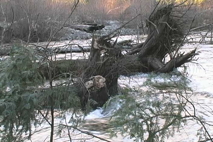
I was drawn by the noise of industrial logging to cross the Englishman River in hip waders, where Morrison Creek flows into the river. The rushing water drowned out all other noise as I braced myself against the forces of nature and moved my feet slowly between the round stones on the riverbed.

I walked downstream along the bank to the place where the South Englishman river brings water from the Mt. Moriarty watershed to join the water flowing from the Mt. Arrowsmith watershed. At times the ‘riparian zone’ along the top of the River bank consisted of only a single tree. A road had been bulldozed along the top of the river’s bank and at times only 30 feet separated the mud of the logging road from the flowing water. Ditches had been dug into the river bank to drain the roadbed directly into the Englishman River. These ditches will encourage silt, mud, machine oils, and debris being flushed into the river with the heavy rains of Spring.

Along the banks of the South Englishman RIver fisheries signs are posted on several alder trees stating: “Fish Habitat” and “Salmon Enhancement Program.” On the north shore of the Englishman River a well established channel system enters the main river just downstream from the logging road and clear-cut. Millions of salmon fry are release into the wild each year while hundreds of thousands return as spawning adults. Englishman River is still the second most endangered River in BC.

A yarder was pulling logs out of the clear-cut as I walked along the river and in the next section I could hear the sounds of a feller buncher. Mechanical progress has made it so that a single worker can fell many acres of trees per day while another worker can yard the same to the road edge. A couple of truckers and the job is done. An entire forest in exchange for only a minimal number of jobs.

I noticed several old growth veteran trees, likely left behind by the first loggers in the 1950’s for a variety of reasons, they provided the area with seeds for an entire generation of trees. This was standard practice in those days and as a result massive Douglas Fir trees still grow sporadically around the entire region.

Then I heard a chainsaw at the base of a group of five veteran trees which towered to a height of over 250 feet. Each veteran was easily over 6 feet across at the butt. For more than five minutes the roar of the chainsaw continued as smoke billowed from the base of the tree. Then, slowly, the giant began to tilt over, gained speed and made a thunderous crash against the floor of the clear-cut. This process was repeated until only three trees stood in the entire clear-cut spread out over 80 acres. (Crown land) portion of TFL 44."

Friday, November 18, 2005

CATHEDRAL GROVE’S FATE STILL HANGING IN THE BALANCE -BC Liberal's Parking Lot or Public will?

I have been privileged to walk in one of the rarest and sensitive ecosystems on the planet, an ancient wetland forest growing on the active floodplain of a meandering river. This Douglas Fir/Sword Fern plant community is red-listed as endangered by the Committee on the Status of Endangered Wildlife in Canada (COSEWIC) and is made even more rare because these giant trees grow in a wetland that is flooded by seasonal rains.

The fact is, Douglas Fir trees do not like their roots to be wet and require drainage in order to survive. Yet some of these trees have been able to survive for over 800 years despite frequent flooding of the entire area. Walking through the forest of Cathedral Grove along the Cameron River, I was impressed by Douglas Fir trees, 6-8 feet across at the butt, perched on mounds and ridges that kept them out of the numerous channels filled by flood waters.

I have given tours of this wetland forest to biologists, forest technicians, silvaculturelists, the BC Minister of WLAP, and BC Parks managers. All but the bureaucrats agreed that disturbing the ground water with gravel, roadways, and an extensive trail system may kill ancient trees that are growing so delicately throughout the wetland forest. When I asked about the kilometer-wide area between the proposed parking area and the present day viewing area the reply from BC Parks managers was that they haven’t done an impact study, environmental study, hydrological study, or vegetation study specific to that site. They did agree that the public tends to stray off designated trails, trampling new paths through the forest.

I have counted seven species of ferns growing amongst Salmon Berry, Cascara, Thimble Berry, and Nootka Rose. Thickets of Devil’s Club grow out of the rich black soil of the bottomlands surrounded by fragrant Stink Current and Red Elderberry. Lichens and mosses hang from the lower branches and trunks of every tree. The variety of tree species, age, thickness, and height creates a living forest that is truly diverse. Standing dead trees provide life to thousands of organisms from fungi and insects to birds.

Massive trees, leveled by the Qualicum Wind of New Year’s Day 1997, lie with their rootballs exposed and covered with a thick forest of seedling trees, Bog Cranberry, Huckleberry, and Trailing Blackberry. Beneath these fallen giants is a reservoir of moisture that endures the drought of summer and provides sanctuary for newts, salamanders, and frogs. A remnant herd of Roosevelt Elk, blue-listed as threatened on Vancouver Island by COSEWIC, winters in the wetland portion of Cathedral Grove. Red-Legged frogs, red-listed as endangered by COSEWIC, live in a pond directly adjacent to the proposed parking lot area. I have also encountered owls, hawks, bear, bats, trout, and many song birds in the wetland forest where BC parks plans to put a parking lot and trail system.

I attended an exclusive power point show where 10 of 11 proposals for parking lots were summarily rejected by the same 7 BC Parks managers making the presentation. This leaves only a version of the original parking lot proposal from 2001 that was rejected by strong public opposition causing years of public protests. I personally handed a petition, with over 10,000 signatures, opposing that very same parking lot location to former Minister Bill Barisoff, yet today it is the only proposal that BC Parks is truly considering.

At the Ministry of Environment’s Port Alberni open house loggers, truck drivers, local government, biologists, and citizens voiced one strong united view point. Don’t touch the park! Resolve issues of safety with an alternate route for the main highway. BC Parks manager Chris Kissinger made it clear that his staff would not be taking notes and that safety issues must be addressed to the Ministry of Transportation, who have ignored numerous requests to present their plans to the public over the past four years. In order to document options from many perspectives, Friends of Cathedral Grove will be holding a round table public meeting, mediated by MLA Scott Fraser. Everyone is welcome on Tuesday December 6 at 7 pm in the Qualicum Civic Centre.

Friday, October 28, 2005

WATER FILTRATION NEEDED - Private Company Ownes Public H20

Once upon a time only mariners knew the words ‘Water water everywhere but not a drop to drink.’ Today we must all heed this very real statement. When e-coli in the drinking water supply for Walkerton, Ontario, killed seven people and made thousands sick, Canadians began to realize just how much we all depend upon clean water. Legal proceedings made it clear to municipalities across Canada that they will be held accountable for any bacteria, virus, or toxins found in the drinking water they supplied to ordinary citizens.

Locally the drinking water supplied to homes is chlorinated but none of the water is filtered in any way. Chlorine kills some bacteria but not e-coli and several other bacteria that may develop when human and animal waste enters the water system. Today the City of Parksville provides water to residents by drawing from wells in the water table, primarily below the industrial zone of Highway 4 and Church Road. Drinking water is also drawn from Englishman River below the orange bridge. The Town of Qualicum Beach relies on wells at several locations including the wetland floodplain along the Little Qualicum River where the new ring road is being completed.

I have hiked most of the rivers and creeks in this area from their sources on Robotham Ridge, Mt. Arrowsmith and Mt. Moriarty downstream to their estuaries. I would encourage you to do the same. All of these waterways thread through different landscapes but have one thing in common; human intervention. Logging companies Brascan and TimberWest provide clearcuts, industrial roads, chemical fertilizer, and some herbicides which run off into the water systems. BC Hydro sprays herbicides along the powerlines which cross all of the watersystems in this area.

Downstream, an increasing number of residential septic fields seep into the water table. Agricultural farms raise livestock and spread manure onto the fields followed by chemical herbicides and pesticides. Surface water from paved roads, ditches, sidewalks, scrap yards, car dealerships, garages, and parking lots is flushed into the creeks and rivers as they flow through the more densely populated areas of towns and cities. Finally, just before the water flows into the Strait of Georgia, the water is pumped into the taps of thousands of residents.

French Creek is unique in this area since their drinking water is not managed by either a municipality or the Regional District of Nanaimo; instead their water is supplied by a private company. Breakwater Enterprises Ltd., a rural water utility located in the French Creek area, provides 1,500 single family homes with drinking water and has being servicing the area for more than forty years. The Edmonton based corporation of EPCOR has applied to the Comptroller of Water Rights to purchase Breakwater and all of its assets.

Lately local residents of French Creek have not been satisfied by the quality of their water, sighting dilapidated storage containers and other faults within the system. EPCOR spokesman David Rector said; “We will implement several capital improvements in the French Creek water system with the priority being a water treatment plant that provides filtration and UV disinfection.” He went on to say that EPCOR plans to stop the use of water from French Creek, reducing demand on the natural resource by some 33 million gallons annually. He is confident that future demands will be met in co-operation with the RDN water supply should the need arise.

EPCOR is holding a public meeting to inform the general public about the possible future of drinking water supplies in the French Creek area. 7:00 PM – 9:00 PM Wednesday November 2 at Oceanside Middle School 980 Wright Road Parksville.

Update February 10, 2006 The Comptroller of Water Rights approved the deal and EPCOR took over the entire French Creek water system. Private ownership of water has been raising public concerns.

Friday, October 14, 2005

ISLAND’S TWO UNESCO BIOSPHERES DO LITTLE TO PROTECT ENVIRONMENT

Biosphere Reserves are areas of terrestrial or marine ecosystems which are internationally recognized within UNESCO's Man and the Biosphere Program for promoting and demonstrating a balanced relationship between people and nature.” While this designation does not provide any legal or physical protection to the environment in these areas, it does draw attention to the region and, according to UNESCO, they have a role to play locally and globally.

I attended the opening ceremonies for both the Clayoquot and Mount Arrowsmith Biosphere Reserves where I listened to municipal, provincial and federal government representatives pay lip service to ecological sensitivity and respect for the environment. Today very little has been done about turning these concepts into a reality.

For several years biologists, environmental groups, and local residents have been calling for a wilderness corridor that would connect the only two UNESCO Biosphere reserves in British Columbia with a very real protection zone for the environment. There is an incredible opportunity, in the mid-island region, for such a ‘park’ that would serve wildlife and tourism in a much more comprehensive way than is currently the case.

The Beaufort Range is being brutally logged today while Mt. Arrowsmith and all parts south have already been clear-cut and are now being logged for the second time. There is only a very fine ribbon of forest left that could be protected to allow the free movement of wildlife across the island. What is left of the old-growth forest in the Cameron Valley, provides access across the island for Roosevelt Elk, and other threatened species, who need to travel in order to continue breeding with a diverse gene pool.

This type of protection takes forward-thinking vision on all levels of government. At the unveiling of the Clayoquot Biosphere Reserve then Prime Minister Jean Chrétien spoke about his role as Parks Minister in creating the Pacific Rim National Park. The vision to protect that wilderness area was brought forward by local individuals and was turned into a reality by elected representatives at the federal level who provided very real protection for several sensitive ecosystems. Today this park provides the economic drive for two vibrant communities which reap the rewards of a thriving tourism industry.

Tourism is about more than just a pit stop at the side of the road. A destination that draws people from around the world also has the opportunity to keep those people for a day or two with educational tours, scenic train rides, and a variety of other activities based around the attractions of a park. The expansion of Cathedral Grove is a good start but plans to put a parking lot and connecting trail systems in the wetland forest, which is the most sensitive area of this class “A” park show the short-sightedness of the BC Liberal government.

Logging giant Brascan, who bought out Weyerhaeuser, is currently heli-logging the banks of the Cameron River where steep canyon walls have protected the ancient trees for centuries. As this sensitive ecosystem is destroyed it will no doubt have a detrimental effect downstream where fish and drinking water are of concern. Keep a careful watch for activity at the yellow gates on the way to Port ALberni just outside Cathedral Grove Park because Brascan plans to log the only substantial old growth forest which has been left outside the park.

I hope that a recent announcement, by BC Minister of Environment Barry Penner, is true and that he will hold public consultation meetings around the issue of Cathedral Grove. Over the past few years I have seen the lack of public meetings and even blatant attempts to mis-inform the public about the reality of logging in a sensitive park system. The time is now to connect the east coast of Vancouver Island with the west coast with a protected wilderness corridor. Perhaps the time has come for the short term goals of the Provincial government to be replaced by a National Park. Please contact your local MLA, MP, and Barry Penner Minister of Environment Phone: 250 387-1187 E-mail: barry.penner.mla@leg.bc.ca

Friday, September 30, 2005

BC CELEBRATES CRISIS OF RIVERS

Watching the Salmon run up the river while children, parents, and grandparents look on with awe, is truly inspiring to me. The interest that the general public has for the wonders of nature is growing. Today our society, and the government that represents it, acknowledges the value of the river systems in this province by dedicating one day of the year as ‘BC River’s Day.’ This gesture is heartwarming and many people take advantage of the opportunity to celebrate the rivers while learning from the many volunteers who work hard to provide informative presentations and valuable tours.

Federal and provincial governments are joined by large corporations in a public relations blitz that shows off all that is being done to ‘help’ the rivers of this province. The positive input is valuable and needs to grow, however the facts behind what is actually destroying rivers need to be addressed. Change is needed to correct the problems at their root rather than treating the symptoms after the destruction has occurred.

For example, a great deal of time, money, and effort has gone into a restoration project which is intended to help restore fish habitat in the Englishman River. This valuable effort is slowly helping to recreate pools that have been washed out over the years. While this remedy is a good step forward, it does not address the cause for the problems of erosion, siltation, and flood surges in the river that have led to the dismiss of salmon stocks.

Logging continues to degrade and destroy the watersheds that feed BC’s rivers. Clearcuts, now labeled ‘variable retention’ by corporations, remove the forest cover that slows down the flow of water. Trees pump millions of litres of water back into the atmosphere where new clouds are formed. The roots of these trees form a complex and interconnected web that holds soil into place. Roads are blasted in a crisscross pattern across mountain slopes, followed by heavy machinery dragging or yarding logs over soil devoid of trees causing massive erosion. This causes silt to be washed down with the rains into the water ways and eventually into the rivers.

Snow pack, built up under the shade of the forest, melts slowly over time and flows into the rivers in small increments. Exposed snow melting, and rain that is no longer diverted by the forest, result in surges of water that become flash floods downstream as the many riverlets converge and become larger creeks and rivers. Logging debris is flushed downstream by the immense power of water which leads to the erosion of river bank. At times log jams cause rivers to completely change their course.

Logging continues to destroy watersheds locally, around the province, across Canada, and around the world. Brascan has closed the gate to the public at North West Bay Road due to logging 7 days a week, so people no longer have access to the watershed that flows into most of Oceanside. Englishman River is listed as the #2 most endangered river in British Columbia, along with most of the rivers on the East coast of Vancouver Island. #1 is the Fraser River. The Little Qualicum is also suffering from logging in the wetlands upstream. Steelhead Salmon are an indicator species that shows just how degraded the rivers have become. The Englishman River used so show returns in the thousands, today far less than 100 fish survive. Salmon enhancement programs help revive the other species but do not solve the problems.

Development continues to encroach on local watersheds with hundreds of new homes being built along the banks of the Englishman River , and plans for many more along the Little Qualicum River. Beautiful places to live, but sewage always flows down hill and many people remove all of the trees to get a better view. Some agriculture also spreads large amounts of manure, chemical fertilizer, and herbicides onto land that was once wetland but has been drained and cleared. The Regional District of Nanaimo built a dam to control the flow of water. Is it working? Questions should be asked of mayors,councilors, RDN directors, provincial and federal government. How is the water being protected or is it just being repaired?

Friday, September 16, 2005

FORESTRY JARGON MADE SIMPLE

“Biogeoclimatic Zones” may be hard to pronounce but what are they? The BC Ministry of forests has created a classification system to provide a framework for making forest and resource management decisions, primarily logging. The word breaks down to vegetation (bio), soil and geography (geo), and climate (climatic). This system allows a variety of forest environments to be named based on their similarities allowing the government to create a map that divides the province into 14 different Biogeoclimatic Zones.

Most of Vancouver Island is identified as Coastal Western Hemlock. This may be somewhat misleading since these forest consists of a wide variety of trees including: Red & Yellow Cedar, Balsam Fir, Alder, Maple, and Sitka Spruce to name a few. One very small zone has been identified as Coastal Douglas-Fir which exists only along the south-east of Vancouver Island, the west coast of Texada Island, and parts of the lower mainland. This zone is significant because it is the region that has been most heavily and consistently logged, with some areas being cut for the third time.

Another interesting term is: “endangered plant communities” which no longer applies since last year’s Water, Land and Air Protection Minister Bill Barisoff amended the provincial endangered-species list to remove endangered plant communities.

The provincial Conservation Data Centre classifies all 21 distinct plant communities within the coastal Douglas fir ecosystem as vulnerable, imperiled, or critically imperiled. Many of us who have the luxury of living in this region are familiar with plant species such as: Oregon grape, Pacific crab apple, salal, ocean spray, trailing blackberry, starflower, sword fern, bracken fern, cat-tail moss, and step moss in the Coastal Douglas fir forests. However, these plants living in this type of ecological community are specific to this tiny place on the planet. Thanks to the BC Liberal government they are completely without protection as are the birds, mammals, reptiles, and amphibians that rely on these unique ecological areas.

Less than 1% of the Coastal Douglas fir ecosystem contains what are considered to be old growth trees, over 150 years old. Only a small fraction of the Douglas fir forest remains on Crown land. Almost all of what's left is on private lands owned by logging companies, primarily by Brascan and Timberwest. Recommendations from a recovery strategy ecological report were ignored by Vancouver Island district forest managers last year resulting in the approval of logging in sensitive area around Nanaimo which were an integral part of a limited ecosystem.

This is why it is so important that protection is maintained in the tiny areas that have been protected locally such as; Cathedral Grove, Rathtrevor Park, Englishman River Falls, and Little Qualicum River. These remnant forests still contain old growth trees, unlike the other 99% of the Coastal Douglas Fir Biogeoclimatic Zone.

This region suffers from extreme drought in the summer time and forest help to retain moisture. The fact that Douglas Fir were the most heavily targeted tree species accounts for the fact that there are almost no old growth trees left today.

Many people are calling for a ban on all old-growth logging on Crown lands within the Coastal Douglas fir zone. Given the limited amount of land left under public control in this limited ecosystem it would make sense to severely restrain logging on all privately held lands around the Strait of Georgia.

If you have concerns please contact your local MLA, Environment Minister Barry Penner, and Forests Minister Rich Coleman through 1-800-663-7867 or www.gov.bc.ca

Friday, September 02, 2005

ENVIRONMENTALISTS PROTECT FINITE WORLD ON BEHALF OF PUBLIC!

Flipping through my Webster’s New World Dictionary I found the definitions for a couple of commonly used words that are widely misunderstood.

“Environment - all the conditions, circumstances, and influences surrounding, and affecting the development of, an organism or group of organisms.”

“Environmentalist - a person working to solve environmental problems, such as air and water pollution, the exhaustion of natural resources, uncontrolled population growth, etc.”

Developers are constantly demanding more land, resources, and opportunities to make a profit for themselves at the expense of the environment that provides for all. When environmentalists attempt to protect an endangered ecosystem they are often put down by catch phrases such as: “they always want more” and “they can’t be satisfied.”

These statements are fitting for the developers. You don’t have to look far to see examples of encroachment and destruction of natural environments for private profit. Beach boardwalks for a high-rise resort, stone breakwater for Surfside RV resort, Englishman River Estuary Flats wildlife sanctuary for Tourism, a ring road in wetland forest to expand Qualicum Beach’s real-estate, pay-for-parking at publicly owned parks, forest and agricultural land turned into residential lots, Hamilton Marsh to be logged and the land sold by Brascan. The list goes on. All these lands are sensitive ecosystems some of which are owned by the public as crown land. These lands effect the surrounding environment and the people who have come to live nearby. The current economic thinking would have us believe that development is progress.

I take another perspective, which is shared by many others around the world, that the world is finite and the more of the natural world that is destroyed by development the less that exists to maintain the world’s environments. Therefore it is in the best interest of humanity to protect the resources that this planet provides rather than to destroy them for the benefit of a few dollars. Cashing in on short term gains may look good on the stock exchange but will completely bankrupt the planet in the not so distant future. Our economic models must be changed to reflect the fact that the planet is running out of resources and therefore the things that make the things that we sell will be gone. No widgets equals no future.

According to a recent study conducted by the United Nations 2/3 of the worlds natural resources (metals, minerals, oil, fish, trees, animals, plants, air, and water) have already been consumed or destroyed by humanity yet we continue to act as if the planet has a limitless supply of these resources.

A wee little park here, a wind blown wilderness corridor there, a dam to hold back some drinking water, and slaughtering a species further down the food chain does not effectively address the concerns of many environmentalists. The big picture needs to be observed in order to realize the equation that makes the world go around. Air, water, and soil qualities are essential to the humanity and all other species living on the planet Earth. These ‘resources’ are interconnected and related to the forests, oceans, mountains and must be maintained in order for us to survive. Weather patterns, quality of life, food sources, and all the necessities of life are directly affected by the destruction of the natural world.

Galileo was executed for proving the Copernican theory that the earth was round not flat as the rulers of the time believed. Yes, the Earth is finite. Yes, the planetary environment supports us all. Yes, we can change our ways, individually in our own ways.

Friday, August 19, 2005

FIRE BAN STILL ON

Swimming up Englishman river from pool to pool, then hopping along the smooth stones and diving into the next pool, is one of my favorite summer activities. Refreshing, scenic, and rejuvenating. I noticed that this year the algae clinging to the rocks below the water is not nearly as thick and robust as last year. Most likely this decline in this slimy growth is due to the cold spring and early summer with all that rain. Branscan and Timberwest are still dumping tons of chemical fertilizers into the watershed.

While swimming up the river I came upon several campfire pits along the shore. Judging by the coals inside a ring of stones a fire had been burning there the night before underneath overhanging branches which were extremely dry. Next I found freshly cut kindling and newspapers beside another makeshift pit in the sand, again beneath tinder dry branches. The wood stacked there was all cedar, which anyone who has spent time beside a campfire knows creates sparks. Finally I found a large ring of rocks piled high with beer cans, cardboard, potato chip bags, and liquor bottles. At the head of the trail down to this swimming hole is a notice put up by the BC Forest Service stating that there is a campfire ban.

This fire ban was put in place on August 5th and is enforceable by a fine of $345. Campfires are banned anywhere south of Campbell RIver on Vancouver Island, this includes all towns, cities, rural communities, and wilderness areas. This fire ban also includes all islands in the Strait of Georgia south of Hernando Island. If you see flames or smoke do not hesitate to phone 1-800-663-5555 or using your cell *5555

All local municipalities and regional districts are in compliance with the Forest Service Ban on Campfires which only allows for gas and briquet barbecues to be fired up until further notice. BC Parks has a policy that allows the warden of any provincial park to decide about fires. This means that private contractors, who sell firewood to campers, can choose to ignore the Ban on Fires within the park boundaries. This is a change made by the BC Liberals that seems to contradict public safety standards aimed at protecting the public from fires.

Many people feel that they can control a fire and based on the fact that they have never had problems in the past, they continue to build fires. The trouble is that the risk is far too great. A little bit of a breeze, sparks from cedar or damp wood, smoldering roots beneath a fire, cigarette butts thrown out of cars, fireworks, and burning paper drifting in the wind. The fact remains that the majority of forest fires are caused by humans.

As a teen-ager I worked around Kennedy Lake when a chain dragging behind a logging truck caused enough sparks to ignite the grass along the road. The result was a forest fire that destroyed hundreds of acres of pristine forest and which took the Mars water bombers and many fire crews several days to subdue.

I have seen many instances where peer pressure plays a part in starting the fire that will become the focal point for a gathering of people, young or old. Someone has to remind the group what the real risks are and ask if anyone is really willing to be responsible for a forest fire that many destroy many homes and has the potential to kill people. You can find out how many fires are burning right now around the province at www.for.gov.bc.ca/protect

We live in a forest that is plagued by seasonal drought. The simple reality is that now until the heavy rains of Fall come, fires are banned. Campfires, fires for ceremonial purposes, fires for heat, fires for cooking, and beach fires are all banned. Please tell your friends.

Friday, August 05, 2005

PARROTS FIND REFUGE IN COOMBS

One of my earliest childhood memories involves sitting in a neighbour’s yard watching multicoloured birds fly inside a large outdoor enclosure. I was fascinated by the colored feathers, shrill calls, flapping wings, and wide open eyes of these beautiful birds as they moved along the various perches. Today I prefer to watch birds in nature.

However, many birds live their lives in captivity and most people do not have the patience, time, or space to allow for a bird to live the natural span of its life. This is particularly true of parrots who are found naturally in the wilds of Africa, South America, and South East Asia where the larger birds can live to the age of 70 years.

Pet parrots tend to be hatched by humans, who they take to be their parents, and never learn the life skills of a wild parrot. Humans are attracted to parrots because of their talking, beauty, social graces, and loving gestures. Most people do not realize how time-consuming parrots can be and these ‘pets’ end up living solitary lives inside small cages. Parrots are intelligent beings who need to be fully engaged, through-out their lives, mentally, physically, and emotionally.

Birds fly! The natural instinct of parrots is to live in flocks which provide them with a certain amount of protection from predators. Many local eagles, hawks, and humans will remember the ill-fated ‘Bird World’ across from the Mid-Island Co-op where exotic birds were displayed for profit until vandals released them all. Those parrots escaped to a certain death in the harsh environment.

I was glad to find that the World Parrot Refuge takes a completely different approach to the plight of parrots. A charity organization, ‘For the Love OF Parrots Refuge Society’, operates this educational facility providing a home for life for previously owned pet parrots.

My first visit to the veterinary hospital in the World Parrot Refuge was both exhilarating and overwhelming. Volunteers introduced me to some of the birds that are healing after horrendous experiences with past owners who subjected them to all sorts of indecencies.

As soon as I entered the hospital the birds began to talk to me and vied for my attention. Despite their injuries these birds climbed across the handmade wooden canopy to greet me. One hopped onto my arm and climbed up onto my shoulder where it tickled my chin with the top of its head. Another hopped onto my foot and began to use its beak and claws to climb up my pant leg. A volunteer pointed out a few of the birds which might not be so friendly. I watched a Green Macaw rip off chucks of wood from a 2x6 table with its beak then I saw a Gray tear open a hard shelled almond nut in one motion. When treated badly these birds can certainly defend themselves.

Next I took a tour of the flight aviaries where staff and volunteers have created wooden canopies for flocks that include many species living together in free-flight environments where their wings are not clipped. Every time an eagle flies by outside the birds on watch by the window let out a shriek of alarm and the entire flock flies for safety. An abundance of toys, food, and companion birds allows these birds to make the most of life in captivity. International laws, lack of natural environment due to human development, and the extinction of many species of parrot in the wild prevent these birds from being returned to the wild.

Today over 400 birds live at the World Parrot Refuge which is open to the public for educational purposes and is located in Coombs at 2116 Alberni Highway. The grand opening takes place on August 13 at 1 pm. For information phone: 951-0822 or check www.WorldParrotRefuge.org

Friday, July 22, 2005

BC GOVERNMENT KILLS EAGLES FOR MARMOTS

Local mountains are home to the last of one of the world’s rarest mammals, Marmota vancouverensis, commonly known as the Vancouver Island Marmot. Today less than 80 live in the wild.

These cute fuzzy rodents are indigenous to Vancouver Island and live in sub-alpine meadows above 1000 meters where their preferred food is the flowers of low growing plants. They dig burrows under boulders which protect them from the elements and predators. They only venture out from their burrows at dawn and dusk to feed and play. In winter they hibernate deep below the snow.

Vancouver Island's largest marmot colony during the past 20 years, on Green Mountain near Courtney, went extinct in 2001. A foundation was set up to try and re-populate the region, spending $900,000 annually in this endeavor. 80 marmots have been bred in captivity near Calgary, however raising wild animals in enclosures does not prepare them for survival in the wild.

After being released from cages by BC Parks officials the young marmots are free at last to scurry through the natural vegetation, revel in the abundance of fresh flowers, and look out over the alpine meadow from rocky outcroppings. Then a predator lands on them and they become a part of the natural food chain. This has happened repeatedly.

In 2002-2003 the Ministry of WLAP acted on the BC Liberal’s 30% predator cull strategy to protect the Vancouver Island Marmot. Several deer carcasses were set as bait in the alpine meadows of Green Mountain. Men with high powered guns lay in wait, then shot and killed a total of six Golden Eagles.

Named for its beautiful dark golden brown plumage the Golden Eagle is larger than the Bald Eagle with a wingspan anywhere from 6 to 8 feet. Golden Eagles are protected in the United States through the US Fish and Wildlife Service. Possession of a feather or other body part is a felony with a fine of up to $10,000 and/or 10 years in prison.

It is illegal to shoot an Eagle in BC yet the Liberal government contracted men to kill 6 of these birds. BC Parks also trapped and killed 11 wolves and 5 cougar, in the vicinity of Green Mountain. The number of bear shot to protect this colony remains unknown. Island predator count estimates are based on the reports of hunter sightings. Is that sound and solid scientific evidence? Although the Marmot Recovery Team openly supports the culling of predators, they deny any responsibility or participation in the culling process because that was a matter for the government to administrate.

Most government and corporate reports would have the public believe that logging corporations are the saviors of these little critters and government is protecting them by shooting the ‘big bad’ predators. How many predators will be shot before they too are considered endangered? Through the power of ‘spin doctors’ the marmots have become a symbol of the logging industry’s compassion for the environment while the species comes ever closer to extinction.

The reality is that logging has devastated the forests of Vancouver Island. A maze of logging roads, clear-cuts, and eroded slopes has destroyed the natural corridors that connect various mountains. Marmots live in very small colonies of 10 to 20 animals. To avoid interbreeding the young males travel between colonies which are often mountains apart.

These small travelers rely upon the natural forested range to provide hiding places as well as the occasional open area where wild flowers can be eaten during the long journey. Logging has ripped open these natural corridors between mountains making it easier for predators to kill marmots. Helicopter logging makes it increasingly more dangerous for marmots as sub-alpine forests are cut down.

A recent photo opportunity highlighting the release of marmots shows that BC’s newly appointed Minister of Environment, Barry Penner, is very much aware of the ‘spin’ value of marmots. If you have questions please contact: barry.penner.mla@leg.bc.ca

Friday, July 08, 2005

DIRECT ASSERTION BY HUU-AY-AHT FIRST NATION FOLLOWING BC SUPREME COURT RULING IN THEIR FAVOUR

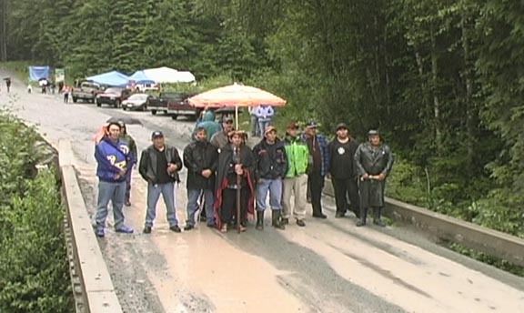
The mist gently rolled down the mountain side as the drizzle became a steady rain. Standing against the guide beam of a bridge over the Coleman Creek I witnessed the chiefs and elders of the Huu-Ay-Aht First Nation reaffirming the boundary of their territory which has been marked by this creek for thousands of years. They were met by chiefs and elders of other Nuu-chah-nulth First Nations, who were welcomed and invited to join in a celebration.

On the road to Bamfield, at the Franklin junction to Carmanah and Sarita, massive ‘off-road’ logging trucks, fully loaded with old growth trees, came to a halt and shut down their engines during a portion of the ceremony. The territory is public land, managed by the BC Ministry of Forests, licensed to Brascan, logged by Hayes.

During the past twelve years Huu-Ay-Aht First Nation have been negotiating in good faith with the Province of BC while logging continued and over six million cubic meters of old growth timber were removed from their ancestral territory, where these people have lived for 10,000 years.

In 1991 the BC government began a process to settle treaties with First Nations. In most parts of Canada treaties had been signed prior to confederation but in BC no such documents or agreements exist. First Nations in BC have never surrendered their lands to the colonialist power of England or the Nation of Canada. In April 2000 Federal and Provincial governments signed the first BC treaty with the Nitsga people. At that time there was hope that many more treaties would soon follow. Then the BC Liberals came to power. No more treaties have been signed to date.

The Supreme Court of British Columbia heard Huu-Ay-Aht First Nation verses The Minister of Forests. On May 10, 2005 The Honourable Madam Justice Dillon ruled; “In this case. The government did not misconceive the seriousness of the claim or the impact of the infringement. It failed to consider them at all. The government acted incorrectly and must begin anew a proper consultation process based upon consideration of appropriate criteria. “

Madam Justice Dillon went on to state; “The level of potential infringement of rights to timber resources is severe given the harvest rate contemplated by third parties over the next five years.”

In her analysis Madam Justice Dillon refers to several recent rulings: Haida Nation v. BC(Minister of Forests) (2004), Taku River Tlingit First Nation v. BC(Project Assessment Director) (2004), Squamish Indian Band v. BC (Minister of Sustainable Resource Management) (2004), Gitxsan Houses v. BC(Minister of Forests) (2002)

There appears to be a pattern emerging with these court cases, which have all ruled in favour of First Nations, whereby the Judge orders the government in the province of BC to follow the rules of law. Negotiations continued, no changes were forthcoming, resources continued to be extracted, and big business continued to make lots of money. No treaties have been signed. Isn’t the government supposed to abide by the law?

“The process itself is to be judged on the reasonableness standard with the essential question being whether the government action viewed as a whole accommodates the collective aboriginal right in question.  The government’s process must be reasonable.”  Hall J.A. admonished in Musqueam Indian Band v. British Columbia (Minister of Sustainable Resources Management), 2005

Robert Dennis, Chief Councilor of the Huu-ay-aht, said; “We believe our non-native friends have a responsibility of phoning the government and saying: settle that issue....get on with fulfilling your legal responsibility...”

You can find daily updates and more information at: www.huuayaht.ca

Friday, June 24, 2005

BRASCAN (Renamed BROOKFIELD) REPLACES WEYERHAEUSER IN BC FORESTS

As a young boy I spent many hours paddling my father around in a canoe while he fly fished the lakes in Northwest Bay logging division. Sometimes we camped overnight or brought friends and relatives for picnics, swimming, or skating. This father’s day week-end the roads to Boomerang, Okay, Round, Cottel, Off, and Kidney Lake were closed to the public due to industrial logging on this privately owned land.

One of the largest business deals in BC has gone almost unannounced. Driving down the highway just south of Parksville you may notice that the green Weyerhaeuser sign has been replaced by a blue sign that states “Island Timberlands” Only those in the know would notice that the odd symbol on the left is the corporate logo for Brascan who announced:

“Toronto, CANADA, May 30, 2005 – Brascan Corporation (NYSE/TSX: BNN) today announced that it has completed the acquisition of Weyerhaeuser's British Columbia coastal business for approximately C$1.2 billion plus working capital, a transaction which included: 635,000 acres of high quality, freehold timberlands; and five saw mills, two remanufacturing facilities and 3.6 million m3 of associated annual Crown harvest rights. “

Locally, Brascan has just bought land that is under serious contention in Cathedral Grove, Hamilton Marsh, on the Floodplain of the Little Qualicum River, on the slopes of Mt Arrowsmith including the Judge’s Route. Local communities and the public have expressed serious concerns about protecting these sensitive ecosystems.

Will Brascan protect these relatively small areas of privately owned land or will this corporation log these highly sensitive forests for the sake of profits? It is posted at www.brascancorp.com “At Brascan, we pride ourselves on contributing positively to the communities in which we operate. From an environmental perspective, that means we are continually striving to minimize our impact on the environment...”

Will Brascan continue to use helicopters to dump thousands of tons of chemical fertilizer into the Englishman RIver Watershed in the same way that Weyerhaeuser and TimberWest did last year? If you would like to get in touch with Brascan to find out their plans regarding local wilderness managed by Island Timberlands, please contact Reid Carter, Managing Partner at (604) 661-9142 or e-mail: rcarter@brascanam.com

Worthy of note is that, while the corporate change means upper management has been replaced, the middle management positions are still filled by most of the same people who worked for M&B, Weyerhaeuser, and now Brascan. Logs are still being exported while more local workers have been laid off in the past month.

“Brascan Corporation is a global asset manager focused on property, power and infrastructure assets. With $40 billion of assets owned and under management, the company owns 70 premier office properties and 130 power generating plants. The company is inter-listed on the New York and Toronto stock exchanges.“

The corporate message is often hard to understand such as; “With a focus on strategic investments in fee simple timberlands in Canada, the United States and Brazil, our Fund investments may also include monetization or securitization of crown timberlands in Canada.” My simple translation is: We will cut down trees on private land as well as on publicly owned land to make lots of money.

Brascan goes on to state: “Approximately 13,000 hectares of lands are viewed to have greater value in non-timber use, located on Vancouver Island and the Mainland. It is expected that the constantly growing rural-urban interface will result in ongoing land sale opportunities.”

Weyerhaeuser sold off a lot of ‘timberland’ as real estate, logged many millions of cubic meters of old growth forest on public land, dumped tons of chemicals into the watersheds of this province, and donated millions of dollars to the BC Liberals. Weyerhaeuser also helped to establish new presidents in the Supreme Court of Canada with regards to First Nations’ land claims and helped to galvanize the environmental community. It remains to be seen how Brascan will act in BC.