Thursday, December 20, 2007

HARPER BRINGS SHAME TO CANADA

This year the winter solstice brings ill tidings to us northern folk. Canada was seen by the world as one of worst adversaries of environmental change.

At the Bali Climate Change Summit nations met to work towards a new global treaty, which would include setting carbon emissions for rich countries. Canada teamed up with the United States to block the consensus reached by all the other countries present at the global summit. Then a group of countries, all of which had signed the Kyoto treaty, tried to move forward without the USA but they were blocked by Canada.

In just a few days 110,000 Canadians joined a petition to let our political leaders know that they were not acting upon the wishes of the general public at the Bali summit. Thousands phoned, faxed, wrote, and e-mailed members of the government. At the 11th hour Canada finally backed down. All countries present at the summit booed the USA. At the last minute the USA finally reversed their negative stance.

600,000 signatures from 192 countries were presented to politicians at the summit demanding they recognize that the citizens of this planet want to work towards global climate solutions. However, as a result of Canada’s negotiations, massive compromises were established at the end of the summit. Regulations for emissions and other environmental standards were lowered significantly to meet the demands of Canada and the USA.

The European nations talk big but they also, are not meeting the regulations to reduce emissions set for the world. The Bali summit has merely established that countries in attendance have agreed to the framework for a Climate Change Treaty, which will be formulated and voted upon at a later date.

At home the Harper government claimed victory at Bali and continues to talk enviro-jargon after putting up a massive fight that has compromised efforts to reduce emissions and environmental damage to the atmosphere of this planet. Meanwhile the vast majority of Canadians want to reduce the environmental footprint we are making upon this planet.

Then again, checkout the malls. How many SUVs, massive trucks, single occupancy vehicles are in the parking lots? Consumerism is the number one threat to the environment. On an individual basis we all have an obligation to reduce the amount we consume. Most products contain plastic, deprived from oil and a great deal of oil was burned to deliver most items to the consumer. How long will the individual actually use the item?

Canada chooses to extract the mostly costly source of oil on Earth, while our government blocks international efforts to reduce green house gases. Many scientists agree that this economic oil boom will become our worst nightmare by destroying the atmosphere that provides us with life.

The largest deposit of tar sands on Earth is located in the Athabasca oil sands of northeast Alberta around Fort McMurray. Tar-sand oil extraction projects do the most damage to the environment of any energy source on the planet. First massive open-pit mining is used to remove the tar, which is fused with sand. As part of the extraction process vast amounts of clean water are used in a process called Steam Assisted Gravity Drainage. The water is then discarded as polluted muck. Today in Alberta natural gas, primarily from northern British Columbia, is piped in and burned to generate electricity used to separate the oil from the sand. Plans are underway to build nuclear power plants to produce the electricity to meet the demand.

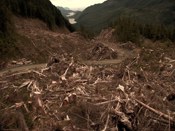
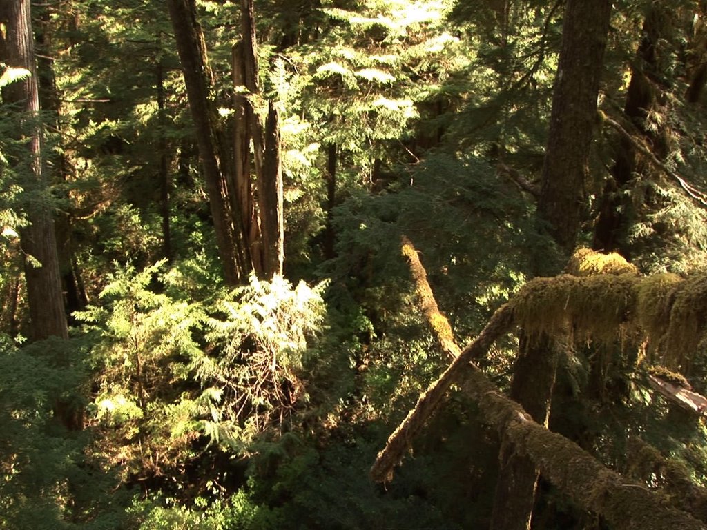
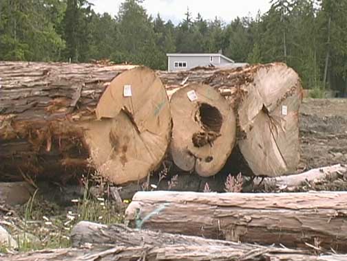
More than 80 kg of greenhouse gases are released into the atmosphere for every barrel of synthetic oil produced in Alberta, each refined barrel of oil weighs 130 kg. Gasoline refined from tar sand extraction is estimated to result in five times more carbon dioxide than conventional "sweet crude" oil production. The Boreal Forest Ecosystem, recognized as a vital part of Canada’s oxygen production and weather stabilization, is being destroyed by massive excavators scraping the topsoil away to dig down into the tar sand.

You can make a difference by joining the global movement which helps to bring the public’s message to the attention of international decision makers, for more information about public input into climate change check out: www.avaaz.org

Friday, December 07, 2007

NATURE TRUMPS HUMANITY

THIS LEDGE NORMALLY HANGS 5 METERS OVER ENGLISHMAN RIVER IT IS KNOWN AS 'THE NOSE' AT TOP BRIDGE

Recent storms have once again proven that nature sets the rules of life. No matter how hard we try to divert water with roads, ditches, dams, causeways, dikes, and culverts a little bit of snow and a few drops of rain wreak havoc over our designs. Human beings are the weakest link in the natural scheme of things. The environment is in control yet we constantly claim supremacy over the world.

As development continues to put pressure on the natural world the attitude that we can manipulate nature to meet our needs seems to prevail over the reality that the natural environment provides for us. The dilemma humanity faces is that we have to learn to protect ourselves from the brutality of nature without destroying the environments that allow us to exist.

An idea such as building a concrete wall with buttresses along Parksville Beach to meet up with the rock dike built by Surfside RV will further change the natural shore line. This ‘solution’ to the problem of erosion flies in the face of the fact that the Englishman River estuary and adjacent floodplains have flooded, receded, and changed for centuries. That is how nature works. There will be serious consequences to altering the coastline to meet economic needs for commercial developments.

Humanity’s attempts to control nature sometimes appear to work, but in the long run devastation is the end result. The planet earth always prevails.

Surfing the web for information about how we, as a society, are addressing the many environmental issues we face, I was not surprised to find that it all comes down to money. Under the heading ‘Environmental Protection’ Statistics Canada lists everything according to revenues and expenditures. Perhaps this is because the information gathered is primarily from tax reports or perhaps it is because money is all that really matters to government.

It’s interesting to note that while the last statscan report was released to the public in September 2007 and all of the information dates back to 2004. Therefore there is no information about any changes that have occurred while the Conservatives, under Stephen Harper, have led a minority government.

To make absolutely sure that the public has no one to hold accountable the statscan website includes the following disclaimer: “In no event will Statistics Canada be liable for any direct, special, indirect, consequential or other damages, however caused.”

It would appear that ‘environmental protection’ has become a major industry in Canada. That may appear to be a good thing but what are the results? That information is much harder to uncover, access, or define. In search of some answers I checked out the websites for both the federal and provincial ministries of environment.

I was amazed at how biased the information has become. The tone is heavily slanted by partisan politics and reinforces the parties in power. Information comes across more like public relations propaganda than statistical information based on scientific evidence.

Both the BC Ministry of Environment and the Environment Canada’s websites read like a series of accomplishments painting a glowing review of the government’s actions on behalf of the Environment. Its almost as if the environment is being used as a public relations ploy that will bring voters to support the political party with the most advertising savvy.

Barry Penner was appointed BC Minister of Environment and Minister Responsible for Water Stewardship and Sustainable Communities on June 16, 2005. His title reads like PR spin and his time seems to be spent on a lot of photo-opportunities which appear to be carefully constructed to provide the biggest bang for the public’s bucks. John Baird was appointed President of the Treasury Board in 2006 before becoming Minister of the Environment for Canada. The website contains lots of sound bites and rave reviews about this politician with no acknowledgement that anything is wrong with how we, and our governments are treating the environment.

Don’t simply rely upon my interpretation of this research check out: www.statscan.ca If you’d like to find out about the BC Environment through the eyes of the BC Liberal government check out: www.gov.bc.ca/env For the Federal view of the Environment check out: www.ec.gc.ca

Friday, November 16, 2007

LOG & FLOG DISPLACES FOREST LAND

I just walked through the ‘not-a-clear-cut’ logged area between Qualicum Beach and Coombs. The second growth forest, once considered a buffer from previous logging, has just been leveled. ‘Single stem variable retention logging’ at its finest. Like sentinels left standing on a bleak and desolate landscape, a few deformed trees remain. A jumble of stumps, exposed root-balls, shattered trunks, branches, and exposed ground cover are all that remain.

Water from Hamilton Marsh flows directly into this wasteland on its way into French Creek. Heavy rains are flushing the silt, mud, and debris exposed by this logging operation into the tributaries of French Creek. Down stream are salmon enhancement projects, community water intakes, housing for thousands, and banks subject to erosion and collapse when run-off swells the creek.

This area is owned by Island Timberlands, which is owned by Brascan, which has changed its name to Brookfield. This “Global Asset Management Company” has just come out of a long strike with local forestry workers. Having logged this area they will be selling the land to a real-estate firm. In order for the unnamed developers to sub-divide and sell this land for residential and commercial uses they will have to apply to the Regional District of Nanaimo for rezoning permits to take this land out of its forest management designation. This will likely be approved unless the public takes a stand.

According to the Official Community Plan, established by the RDN and dedicated members of this community, this land is specifically reserved for forest management. The logged area closest to the Inland Highway is part of the RDN Area “G” while the clear-cut along what was once the ‘Coombs cut-off’ is in Area “F.” Rezoning would have to be approved by the RDN Board of Directors, which includes both local mayors.

The forest around Hamilton Marsh is also owned by Island Timberlands, which recently rejected a fair market value offer from the Regional District of Nanaimo in partnership with Ducks Unlimited Canada to purchase the land and protect it as park. Based on the direction Brookfield is taking, all forestland in the area will be logged and sold to real estate developers.

The provincial governments - the NDP initiated this legislation and the BC Liberals boast they have completed the task - claim they have protected 12% of the land base as parks. However, the majority of people living on Vancouver Island are concentrated along a thin corridor along the east coast from Campbell River south. In that area less than 7% of the land has been protected as parks. The primary reason is because industry and private people own most of the land.

All of the land between Victoria and Courtney along the East Coast of Vancouver Island, along with all land West to a line that runs between Port Renfrew and Port Alberni, is privately owned. In 1884 Prime Minister John A. Macdonald convinced coal magnate Robert Dunsmuir to build the Esquimalt and Nanaimo Railway, something he had promised the citizens of British Columbia in order for them to join confederation in 1871. The government in Ottawa paid Dunsmuir $750,000 cash and 2.1 million acres of land on Vancouver Island along with all mineral rights.

Over the years the E&N lands were sold to small and large companies as well as to private individuals. As a result this entire Dunsmuir land area is not accessible to the general public and remains out of the jurisdiction of all levels of government. Most streams, lakes and swamps on the east side the island are held privately, including the bed of the water body.

One way out of this land squeeze is to limit re-zoning of land to that of the OCP. As it stands, the land Island Timberlands has logged is not zoned for housing or commercial development. Should they decide to ‘donate’ the entire forest around Hamilton Marsh to the RDN as a park, then their development firms may have a chance for re-zoning. Until then the limitation of forestland remains in place.

Contact Electoral Area “F” Director Lou Biggemann and Area “G” Director Joe Stanhope at Regional District of Nanaimo 6300 Hammond Bay Road Nanaimo, BC V9T 6N2 as well as Community Planning 954-3798 E-mail: Planning@rdn.bc.ca

Thursday, November 01, 2007

HUMAN INTERVENTION CAUSES BEACH EROSION ON PUBLIC COASTLINE

Oceanside prides itself on the fact that it is located along some of the finest beaches in British Columbia. People from around the world come here to enjoy the coastline and many of them retire here after multiple vacations. As a result the population is growing rapidly and demands on the shoreline have increased.

Parksville Beach has changed a great deal since I graduated from high school. Over time pavement, fences, grass fields, and blasted rock have taken over from the natural aquatic grass and sand. A hovercraft, operating from the coast guard station at the end of the point, regularly drove out over a flat beach at low tide and launched itself into the water. Today a massive gravel bar has emerged just off shore from this same point.

According to some experts the erosion of the Parkville’s shoreline may be the result of tidal and storm pressures being deflected into the bay by this large gravel bar. As a result the city has installed sections of blasted rock to prevent the paved road from being washed away. The City of Parksville is considering more changes to the shoreline in an attempt to stop this type of erosion.

The main change to that section of coastline is the massive blasted rock causeway built by Surfside RV Resort, dividing the Englishman River Estuary Floodplains from the Strait of Georgia. Man made changes to the natural coastline effect the flow of water by redirecting tidal and storm surges. All along the coast private land owners have installed dikes, concrete walls, and other barricades in order to alter the natural erosion of the shoreline.

An area known as the ‘Queen’s Land’ along all waterways was once protected from development but today it is very easy to obtain a license which allows property owners to alter the coast. Governments at all levels have abandoned the protection of the shoreline in exchange for increased tax revenue from expensive waterfront properties. However, there remains a legal right of way along all waterways which is accessible to the general public which can not legally be blockaded by private property owners because the ‘Queen’s land’ belongs to all citizens of Canada.

In September the Stewardship Centre for British Columbia announced that it had been awarded a grant of $100,000 by the Real Estate Foundation of British Columbia for the Green Shores sustainability project. With a focus on social and economic development, the Green Shores Project aims to promote healthy coast and marine ecosystems by planning a design while working to benefit the environmental. It provides positive examples for property owners, developers and design professionals to address environmental and sustainability issues associated with increased waterfront development. Unfortunately, as a non-profit society it cannot enforce it’s recommendations but does provide information and tools to assess shoreline property and habitat protection.

“The need for sustainable approaches to waterfront development in the Georgia Basin and Strait of Georgia is accentuated by unprecedented residential and commercial growth,” said Project Coordinator Patrick Walshe. “Frequently we try to immobilize shorelines with cookie cutter solutions, yet too often this destabilizes the shore and its ecosystems, jeopardizing our coastal resources as well as the beauty and character of our coastal communities. There are many green alternatives in our tool kit, which can be catered to solve site specific issues more effectively.”

The project team will help to educate land managers, designers, planners, developers and builders working on ocean front development on Vancouver Island and the Georgia Basin, in an effort to develop alternative design concepts.
For more information visit the Green Shores website at http://www.greenshores.ca

Thursday, October 11, 2007

PLASTIC! PLASTIC EVERYWHERE!

I do a lot of hiking around the Oceanside area and it always amazes me, when at the end of a long series of logging roads or trails, to find garbage. Primarily plastic garbage. The most common are shopping bags, potato chip bags (plastic lined with aluminum), plastic used to hold aluminum cans together, car tires, and cigarette-pack-wrappers. Just take a look over the cliff on little mountain where the garbage has been piling up for years. Clean-up crews along the highway seem to be on endless duty picking up what people throw out of their cars. Littering is illegal and punishable by fine.

Most of these items are produced from petroleum, which has been refined, and then processed into products that take a very long time to disintegrate. Refining crude oil is a process whereby the most toxic and noxious chemicals are burned off into the atmosphere. A great deal of CO2 emissions are emitted prior to any oil products reaching consumers, these pollutants contribute to global warming by building on the green house gases effecting the planet’s atmosphere.

What is really astounding is finding garbage bags, twist tied and full of house hold garbage, that someone has taken this much care and attention to dump at the end of a long road in the wilderness rather than take it to a transfer station or a dumpster. Even worse, I’ve witnessed people burning plastic in their campfires as well as in barrels to get rid of household trash. Sure, it may seem easy to toss plastic bags, plastic utensils, styrofoam plates, and other plastics into the fire but the toxic fumes do contribute to green-house effects in the atmosphere. Like the canary in the mine, many species of birds have been dying due to toxins in the air we breath.

Of course the best way to avoid problems associated with plastic is to reduce the amount of plastic we consume as individuals. An easy start is at the grocery store, where millions of plastic bags are given away free. In Europe the standard has always been for people to bring their own hardy bags to the grocery store to put their products into for the trip home.

As most tourists who have visited Europe will attest, if you have no bag with you the store will sell you one for a minimum charge of $0.50 per bag. As a result most Europeans provide their own bags, this has become the norm rather than the exception. If local grocery stores began to charge for every plastic or paper grocery bag how long would it be until everyone brought their own bags. Which grocery story will start this trend? Perhaps they need some encouragement from you, their loyal customers. Many stores already provide strong durable bags at a small price.

Fleece and other polyester clothing is now available made primarily from post consumer recycled plastic materials. After all polyester is merely plastic spun together to make threads, which are then woven together into garments. Buying these recycled cloths supports an industry that is using up those plastic bags we need to reuse. By extending the use of these plastics you are preventing more crude oil from being refined to make polyester thread, less toxins in the atmosphere, less plastic to disintegrate.

Plastic containers are turned into building materials, which are now available at your local lumberyard in the form of studs and other forms of structural products. The Regional District of Nanaimo and all local municipalities have adopted a zero waste strategy, which allows the public to include plastic containers in their blue box for recycling. Those very same blue boxes are made from recycled plastic. For collection rules and more information contact: www.rdn.bc.ca

It is a well-known fact that much of the CO2 emissions are produced from car engines burning gasoline, but there are many other ways that we use oil derivatives in our daily lives. Every drop of oil represents a landscape devastated by extraction, drops spilled along the way, gases emitted into the atmosphere in the refining process, and transportation costs including oil spills. Take care with how much plastic you consume and be careful how your deal with your garbage. If you would like to report illegal dumping contact local RCMP or the RDN toll free 1-877-607-4111

If you live elsewhere I can garantee you will find similair problems on any backroads. Please let your local government know.

Friday, September 28, 2007

SAVE OUR RIVERS NOT OUR IMAGE

Today society struggles to strike a balance in watersheds that have been battered for the past 150 years by logging, development, gravel mining, and road building. Despite this, and the fact that water is a precious resource, the destruction continues.

For many years now the Englishman River has been considered one of the top most threatened rivers in BC according to the Outdoor Recreation Council of British Columbia, with a total of 120,000 members. (www.orcbc.ca) Englishman River is considered to be an example all of the rivers on the east coast of Vancouver Island, that flow into the Strait of Georgia Basin. All of these rivers are in a serious state of stress and decline.

The indicator species used by many biologists to determine the health of these rivers is the Steelhead Salmon, a species that returns to spawn many years in a lifetime. Snorkel teams counted 471 adults in February 1985, which was cause for alarm at the time since the returns once numbered in the thousands. By the year 2000 the winter count was 15, a count that went up to 43 in 2006.

A lot of attention has been directed at the Englishman River to try to bring the salmon back. A ‘salmon enhancement’ program has involved diverting water into excavated channels, ditching, egg and milk extraction, incubation pens, and fry release.

Multinational logging companies, TimberWest and Island Timberlands, continue to destroy the banks of local rivers with tree removal and road building. The resulting landslides, land erosion, and surface disruptions lead to massive amounts of dirt and debris in the flow of water. Heavy rains flush silt, loosened by logging equipment and dragging of logs, into rivers. Buildup of silt is known to suffocate salmon eggs buried in gravel. Channeling of water results in higher floods, which further erode riverbanks and level out pools.

Over the years governments have addressed some of the issues that face the watersheds locally but they tend to avoid drawing attention to the root causes of the damage. Instead, they claim that logging corporations provide valuable money for rehabilitation. These logging companies get massive tax breaks in exchange for money that is put into river restoration projects.

In the case of Englishman River attempts have been made to recreate pools and safe refuge for small salmon fry that get washed away when the river gauges out straight wide expanses between ever widening banks. These projects involved massive excavators, dump trucks, blasted rock, steel cables, logs with rootballs purchased from logging companies, chainsaws, and of course manpower paid with provincial and federal tax dollars.

River restoration, while logging the banks of the very same river, is similar to sticking a knife into your stomach and then trying to cover it over with band-aids rather than pulling out the knife and then attending to the wound.

Fisheries and Oceans Canada manages fish. The BC Ministries of Forests and Environment do not regulate logging on private land. The Regional District of Nanaimo is responsible for the dam at the source. Logging companies, various developers, and private landowners all stake their claim to the land on the banks of the river. Who is looking after the interests of the river and watershed?

On BC and World Rivers Day Sunday, September 30 much attention will be directed at the new Top Bridge Crossing where the Regional District of Nanaimo will be kicking off the grand opening of the new Englishman River Regional Park. Having spent $500,000 on a steel suspension bridge you can be sure to find many politicians.

Meanwhile a group of dedicated volunteers will be providing tours along the floodplain of the Little Qualicum River where Chinook Salmon are currently spawning. Sarah Casley, Education Coordinator for Fisheries and Oceans Canada will be performing a salmon dissection beginning at 11:30am. The largest Sitka Spruce on the east coast of Vancouver Island is hidden inside this jewel of a forest. Access is at the end of Kingkade Road just north of Qualicum along the Island Highway. The Little Qualicum River has received very little attention from local, provincial or federal government and continues to be threatened by development and logging.

Friday, September 14, 2007

AERIAL GARDENS IN THE ANCIENT CANOPY

On the Labour Day weekend I climbed the largest Douglas fir tree in the world, actually I took the elevator up. In order to operate my video camera I work with a team of professional tree climbers, all of them arborists, who rig the ropes. They hook my harness up to a rope while another climber, who has climbed up the tree beforehand, is attached to the middle of the same rope. A pulley allows him to act as my counterweight and a ground crew uses the rope to pull him down to the ground. I am lifted gentle up into the crown of the tree.

Moving up along the massive trunk of this Fir tree reveals deep grooves woven randomly in the bark, some as deep as 6 inches. Spider webs span these ravines, shimmering in the light. Many species of lichen adorn the brown/grey bark with bright splashes of white, green, and yellow. I float by the remains of a nest made by a tiny bird, perhaps a winter wren, fitted snuggly in a hole bored by a woodpecker.

At about 100 feet a lush aerial garden is wedged into the crotch where the first branch juts out from the trunk. Licorice ferns pock out of the thick mat of moss and lichens that clings to the top of this massive bough. The bright red dots of huckleberries contrast with the various shades of green and yellow moss as 3 huckleberry bushes stand firmly in the breeze. A 4-foot hemlock tree dominates this suspended paradise.

The Red Creek Fir is a ‘World Champion’ tree with the greatest volume of its species in the world. This is according to the Big Tree Registry of British Columbia, which lists the top 10 trees of every species. www.env.gov.bc.ca/bigtree For some reason this Fir was allowed to stand while the forest around it was completely leveled by clear-cut logging, in fact the old logging road runs past the base of this incredible tree. This giant is 13.28 m (43’7”) in circumference, 73.80 m (242’) tall, with a crown spread of 22.80 m (75’)

I continued up the elevator to approximately 150 feet where the view of the San Juan Valley is incredible. Unfortunately gaping holes in the forest below reveal recent clear-cut logging in second growth forest. The entire valley has been logged and now Western Forest Products (WFP) is logging the area for the second time, faster, with larger machinery, and fewer workers.

We then moved to the other side of the valley where the San Juan Sitka Spruce grows. This is the largest Spruce in Canada with an 11.66 m (31’5”) circumference, height 62.50 m (205’) and 23 m (75’) crown spread. The massive trunk branches into several adjacent trunks, which are larger than many large trees.

Once the ropes were rigged I had to do some work and climbed a rope 200 feet to the top of this tree. Along the way I stopped frequently to admire the many aerial gardens along the way. Many large branches protrude from the trunks of this tree, providing platforms of moss, ferns, and small bushes. These platforms are ideal habitat for Marbled Murrelet, a red listed endangered sea bird which nests only in old growth forests.

Looking down at the San Juan river I am surrounded by many aerial gardens teeming with life. I am astounded to see two 3 foot tall ‘bonzai’ Douglas Fir trees growing out of the top of the main trunk which was blasted off by lightening many years ago. A 14 foot tall hemlock grows off another trunk, along with many smaller trees, bushes, ferns, moss, and lichens.

I’ve been climbing trees for a few years, pulling together a team that is allowing me to shoot a film about the canopy of the ancient rainforest of Vancouver Island. The climbing system we use allows me to move into the canopy with the least amount of damage to the tree since the gigging ropes are what my team and I climb on with only a few points of contact with the tree itself.

I have climbed with several researchers, including a team of Entomologists from UVIC who have been climbing into the canopy where they have discovered no less than 125 species of insect that were previously unknown. For more information: http://web.uvic.ca/~canopy

This abundance of evidence proves that we know very little about the ancient rainforests. 85 of 91 watersheds on Vancouver Island have been heavily logged and less than 5% of the low valley bottom forest remains intact.

Tuesday, January 23, 2007

FEDERAL ENVIRONMENT MINISTER PROMISES CHANGE - LETS HOLD HIM TO IT

Canadians are demanding immediate attention to protect the environment and Prime Minister Stephen Harper claims to be listening. He has appointed a new Minister of Environment, John Baird, to address the many concerns Canadians have about the environment.

In anticipation of an upcoming national election the rhetoric is flying and promises are being made. Today the iron is hot and any input will receive some attention from the office of the new minister. I encourage you to contact him. It is always wise to send a hard copy by snail mail but remember that e-mail, fax, and phone will each be processed by a different civil servant. The more people in the office that are made aware of your concerns the better. CC to related ministers at the same mailing address. Here is my letter welcoming the new minister:

The Honourable John Baird
Minister of the Environment
House of Commons
Ottawa, Ontario K1A 0A6
Telephone: (613) 996-0984
Fax: (613) 996-9880
E-Mail: Baird.J@parl.gc.ca

Dear Minister,

I am glad to hear Prime Minister Harper is finally beginning to listen to the people of Canada with regards to the Environment, and has appointed you to this important portfolio. It is time that the federal government of Canada fully implements the Kyoto Protocol to which Canada is a signatory.

Living in British Columbia I am very concerned about three key issues that are currently being initiated by the provincial government and which should be stopped by your office, since they affect the country as a whole and therefore must comply with Canadian standards for the environment.

The public has been led to believe that offshore drilling in the coastal waters of British Columbia has been put to rest by the federal government’s continued support of a moratorium. However, the BC government continues to allow sonic testing on the ocean floor and acts as if the moratorium will be lifted in the near future. I encourage you to stand firm by maintaining the moratorium on offshore oil and gas explorations in BC. In 2004, the federal government asked British Columbians their views on the moratorium through a public process that involved 3,700 individuals, many of whom work and live on the coast of B.C. Seventy-five percent of the participants told the federal government they wanted the moratorium on offshore oil and gas maintained. 70 BC First Nations were involved in this review, all of them support the moratorium. BC voters continue to says no to offshore oil and gas.

Put pressure on the BC provincial government to stop plans to build 2 coal-burning power generated and associated open pit mines. On December 21, 2006 Environment Canada released new greenhouse gas emissions data showing that across Canada in 2005, coal-fired generating plants belched out 280 million tonnes of greenhouse gas emissions and remained among the nation's biggest polluters. Since your office is committed to reducing gas emissions you must stop the BC government from building new coal-burning generators.

Stop all logging in what little remains of old growth forests in Canada. Science has determined that forests are extremely important to the life cycles and functions of this planet. Trees filter air by taking carbon, nitrogen, phosphates, and other airborne chemicals in the atmosphere and fixing them into the soil where they can provide nutrients, in turn producing vast amounts of oxygen. Rainforests redistribute water, functioning as huge sponges to retain water and pumping vast quantities of water back into the atmosphere. Large tracts of intact forest help to stabilize weather patterns both locally and globally. Biologists have also determined that a ‘healthy forest’ is made up of trees that are multi-aged, multi-species, multi-sized, and multi-layered. These types of variations are only found in old growth forests and are not found in tree plantations. In fact scientists have determined that the rainforests found in the low valley bottoms on the west coast of Vancouver Island have a biomass greater than anywhere on earth, meaning that the density of living organisms per square meter surpasses even the famous Amazon rainforest. On Vancouver Island less than 10% of the original old growth forests remains, they must be protected.

It is time that our federal government gives priority to protecting the environment. I encourage you to act as do most of the people that I know.

Sincerely, Richard Boyce, BFA, MFA
Errington, British Columbia

cc. Gary Lunn - Minister of Natural Resources (Lunn.G@parl.gc.ca)
Stephen Joseph Harper - Prime Minister (Harper.S@parl.gc.ca)

Wednesday, December 27, 2006

BC ENVIRONMENTAL SUMMARY 2006 - YOU MAKE A DIFFERENCE

“We affect the environment - for better or for worse”
2006 was a big year for environmental issues, both locally and provincially.

In April Environment Minister Barry Penner announced that his government would not proceed with plans to build a parking lot in Cathedral Grove. Logging along the sensitive Cameron River floodplain has not commenced, neither has the expansion of the park been publicly marked with new signs, and no legislation has been passed to formerly protect this sensitive ecosystem.

The logging of Hamilton Marsh has been put on hold while the RDN negotiates with Island TImberlands (owned by Brookfield formerly Brascan)

A Parksville Qualicum Water Conference entitled “Our Water, Our Future” looked at the local and global issues facing drinking water, a follow-up conference in 2007 will work towards solutions.

Fisheries and Oceans Canada is responsible for protecting riparian corridors, along the waterways of this region, in order to protect key fish habitat. Timberwest has logged to the banks of the Englishman River across from Morrison Creek and the Salmon Enhancement Canals. Island Timberlands Helicopters have logged the narrow steep banks of the Cameron Rivers, in an area know as Cathedral Canyon. Island Timberlands also plans to log the steep slopes directly above Englishman River Falls Provincial Park.

A private land owner built a house in Squitty Bay provincial park, on Lasqueti Island. After a public outcry Barry Penner, Minister of Environment responsible for BC Parks, gave notice to this squatter and allowed her 6 months to move out. Today the house remains as does the squatter. The BC Liberal government continues to move towards the privatization of BC Parks which will allow private operators to build and charge for services within publicly owned parks. Who will grant these rights and monitor that the parks remain accessible to the public?

East Creek, Carmanah Valley, and three watersheds in Clayoquot Sound are all that remains of the intact ancient rainforest on Vancouver Island. This year logging began in East Creek and the Clayoquot Sound watersheds, despite the fact that most people believe that these areas are protected by the BC government. Logging licenses on these publicly owned lands have been granted by the BC Ministry of Forests.

The Great Bear Rainforest deal was signed at the beginning of the year and was to protect the largest intact temperate rainforests in the world. A public relations campaign initiated by the BC Liberals has worked to win over BC voters and tourists alike as is evident by the ‘artistically’ painted Spirit Bears found all over Victoria and Vancouver. The reality is that the deal to preserve 1.8 million hectares of land along B.C.'s Central and North Coast is falling apart as Timber companies increase the rate of clear-cut logging to unprecedented levels.

More trees were cut down in 2006 than in any year in the past. Raw Log Exports have increased, the annual allowable cut has increased, and the number of forestry job has been cut dramatically. BC Ministry of Forests sells our trees at extremely low prices to logging companies. Low stumpage fees allow for the price of exported wood to be considerably lower than competitors south of the border. Ironically Timber companies continue to post massive profits. The soft-wood lumber agreement, being signed and negotiated by provincial and federal Forest Ministers, does not include raw logs. The closing of many saw mills through-out BC is directly related to the disagreement and has allowed for the increase in raw log exports.

Fish Farming expansions continue to be approved by the BC government despite evidence that escapee’s, sea lice, excess feed, and contaminants produced by these fish pens are causing the death of wild salmon stocks.

The abundant shellfish found on the beaches around Hartley Bay have been contaminated by diesel fuel that continues to leak from the sunken BC ferry Queen of the North, once again proving that disasters do happen in the coastal waters of BC. The lifting of a federal moratorium on off-shore oil explorations has been a priority for Premier Campbell’s government who plan to have oil rigs and massive oil tankers navigating these same waters regularly.

The United Nations called for a ban on all dragnet fishing. Fisheries and Oceans Canada has thus far ignored this pleas to protect the ocean floors, despite scientific evidence that show that coral and other bottom dwelling organisms provide the basis for the existence of life in the ocean.

Premier Gordon Campbell’s government has said no to wind and solar energy, instead pushing forward plans to build two massive coal burning furnaces and associated open pit mines. Despite the PR spin put on this issue, scientists conclude that coal burning furnaces to generate electrically is the single dirtiest (in terms of pollutants such as NOx, SOx, mercury, etc.) and highest generator of CO2 of any form of power generation.

You may have already had an impact on these issues, or you could help to change them in the future. Individuals do change the world. Let’s make 2007 a HAPPY NEW YEAR!

Friday, November 24, 2006

PRIVATE MILL WREAKS HAVOC OVER ERRINGTON

LOGS FROM YELLOW CEDAR TREES THAT GREW FOR OVER A THOUSAND YEARS ARE BEING MILLED BESIDE RESIDENTIAL HOMES IN ERRINGTON, B.C.

7 am - the beep of my alarm clock is drowned out by the piercing beep of several massive front end loaders backing up, their engines roar as they lift massive logs, their tires spinning in the mud. I listen to the Errington Cedar Mill, a full 500 meters away, as the giant wood chipper grinds into action. A loud noise similar to standing beside an old blender grinding nuts or a belt sander tearing into a piece of wood. Very loud, very grating on the nerves, with bursts of 1 to 2 minutes every 10 to 15 minutes between 7 am and 5 pm wee days and often on week-ends. Each time the chipper spins to a halt, it is drowned out by the constant drone of saws, edgers, and planers. Trucks honk, chain saws roar, and the log loaders continue to roar and beep incessantly.

Years of public consultation, during which countless residents voluntary dedicated their time and energy, resulted in the official community plan (OCP) for Area F, which was legally drawn up by the Regional District of Nanaimo in 1999. This document designates most of Errington as Rural/Residential with the “Village Centre” being the most densely populated as well as the cultural and social hub of activities since the early 1900s. However the RDN has allowed heavy commercial industry to grow unchecked in the heart of Errington. In fact industry is consuming the heart of this community.

I regularly meet fully loaded logging trucks on Grafton Avenue, which has no paved shoulder and is not designed for heavy commercial traffic. I can only imagine the choice left to a school bus driver when facing one of these massive logging trucks. The rural residential make-up of Errington means that Grafton is frequented by horses, cyclists, children, and parents with infants in strollers.

These logging trucks bypass the old Alberni highway, designed for commercial traffic, in order to dump their logs at a new dry land sort leased out by the Errington Cedar Mill. The logs are then reloaded and once again driven through the heart of this community seven days a week including holidays. Chip trucks, logging trucks, and loaded flatbeds all make a very wide turn at the Errington store taking up several lanes at this busy intersection, which most residents of Errington must drive through daily.
Officials at the RDN admit that no changes have been approved for the property yet the original zoning mentions only a single sawmill as the permitted principle use. Albert Orcutt started Errington Cedar Products with Brad Meeker, owner of Meeker Lumber Ltd. of Mission, B.C. Together they have been able to secure 5 million board feet of old growth Western Red Cedar and Yellow Cedar logs annually.

While attending Errington Elementary School my class took field trips to the 14 acre farm next door where we observed a large sow pig with a litter of tiny piglets, cows being milked, and other animals in the barnyard. The ALR allowed the land to be stripped of most of the topsoil, watched a massive mill be built, and much of the area to be paved. After all of this the ALR approved the removal of this property from farm status on the grounds that the property could no longer support a farm.

This summer all of the trees at the back of the property were removed, the soil piled up, and a new road pushed in along the property lines of several long time residential homes. Ditches were gouged out along Christian Road to increase the drainage away from the mill. The dust retardant promised by the Ministry of Transportation was never applied as fully loaded trucks roared up and down the new road, sometimes well into the night. Some arrangement has been made so that logs are being sorted and scaled in downtown Errington, surrounded by residential homes, at a new land sort.

Designated industrial zones allow for residential and environmental concerns to be addressed while providing industrial grade infrastructure, safe highway access, and better emergency response. An OCP is meant to be strictly monitored and enforced.

If you have concerns please contact RDN Community Planning (250) 954-3798 E-mail: planning@rdn.bc.ca and/or local MLA Scott Fraser Toll free: 1-866-870-4190 E-mail: scott.fraser.mla@leg.bc.ca and/or Ministry of Transportation Barbara Thomas (250) 751-3126 E-mail: barbara.thomas@gov.bc.ca

Friday, November 10, 2006

WATER FLOWS INTO PEOPLE’S FUTURE

EMERALD LAKE FROZEN OVER BELOW MOUNT ARROWSMITH

Many of the trails I frequently use to walk along the banks of Englishman River were flooded as I made my way along the swollen waters near Top Bridge municipal park. “The nose” was level with the roaring water, brown with silt from fresh logging cut-blocks up stream. The week before I stood on top of the same rock shelf and noted that I would not want to dive for fear of hitting the bottom because the water was so shallow. That means the water rose approximately 5 meters in about 2 days. What a difference a week-end can make!

After many months of drought the rain finally came on the same week-end when water was the focus of a Parksville Qualicum Water Conference entitled “Our Water, Our Future”, attended by more than 350 people at the Qualicum Beach Civic Centre. Opened by Qualicum Chief Kim Reculma-Clutesi, who welcomed everyone and encouraged people to come together to protect water, the importance of drinking water as a global and local issue was raised.

According to the leaders at Kyoto: “We are water warriors.” This is a human issue and only human beings can resolve the vast number of problems, most of which we have created. Act locally, think globally is an old catch phrase that is appropriate.

Severn Cullis-Suzuki pointed out that a litre of water can cost more than gas and produces a plastic container that is added to the 2.5 billion discarded every year. She suggested that using a personal reusable cup to drink coffee would help reduce the number of throw away cups which, if placed end to end, would circle the planet 7-8 times annually. 45,000 gallons of water are used to produce a single car. Cullis-Suzuki inspired the crowd with her stories of people from around the world coming together to protect the environment.

The largest aquifer on the planet lies under Brazil, Argentina, and Uruguay. When private corporations and government tried to privatize the drinking water in Uruguay, three million people protested. As a result the constitution was re-written after a 67% plebiscite to stop privatization and protect water. The constitutional amendment states:” Water is a human right.”

A statement from the UN indicated: “The wars of the 21st century will be fought over water!” Tony Clarke, Executive Director of the Polaris Institute, ended his speech with: “Water must never be completely controlled. Water must flow freely.”

Tofino councillor Michael Tilitzky explained that bylaws now make it mandatory to use dual flush toilets which use 3 litres per flush rather than the traditional 13.5 Why is this not a provincial law? Tofino is thinking beyond pipes and pumps by focusing on conservation as the solution to the problems of water shortages and increased demand on the limited drinking water supply.

Logging continues to effect local water by reducing the natural forest filters, eroding top soil, and reducing snow packs. Water flows without regard to boundaries yet is treated differently depending if it flows through private or public land. The ‘Private Forest Land Management Act is currently under review. This legislation establishes logging, road building, development, and other regulations for private land. Public input is needed. Voice your concerns to: BC Forest Minister Rich Coleman FOR.Minister@gov.bc.ca (250) 387-6240

Near the end of the workshop portion of the conference people came together to come up with positive tasks for people to work on to change the current status of water. Some of these included: Amending the Canadian Constitution to include “Drinking Water is a Human Right” This would create protection for water from the highest level and trickle down to every aspect of Canadian living. Lobby the local Health Authority to enforce water protection, particularly industry. Call for legislation to protect the water aquifers and ground water in this province.

Consensus was to hold a follow-up conference which will focus entirely on building solutions to the many issues facing water. Keep an eye out for information and checkout www.arrowsmithwatersheds.org

Friday, October 20, 2006

WHERE IS THE FALL SESSION OF THE BC LEGISLATURE PROMISED BY CAMPBELL'S LIBERALS?


CATHEDRAL GROVE REMAINS UNDER THREAT FROM BC LIBERAL UNTIL LEGISLATION IS PASSED

To date the boundaries of internationally renouned Cathedral Grove Provincial Park, located between Qualicum Beach and Port Alberni on Vancouver Island, have yet to be written into legislation. The sign welcoming people into the park has not been moved 3 km towards Port Alberni to reflect the new park boundaries.

The fact that BC Minister of Environment Barry Penner has made several public announcements regarding the park, none of these statements are reflected in law today. According to the BC Liberals this park has doubled in size, no parking lot will be built on the much protested location, and parliament will be held in the spring and fall of every year in order to legally pass legislation into law.

Political debates that are supposed to mark democracy in this province have somehow faded away. The Fall session of the legislature has been canceled with no fanfare and the Legislative Assembly remains silent.

When the BC Liberals were elected in 2001 they made many promises. They guaranteed that the Legislative Assembly would hold both a Spring and Fall session, establishing a parliamentary calendar which scheduled 11 week in the spring between February 14 and May 18 and 7 weeks in the fall between October 2 and November 30. This year there will be no fall session. The BC Liberal government has stated very little publicly about this major omission in how government is run in BC. Mass media seems to have missed this story completely.

Members of the Legislative Assembly (MLA) each hold a parliamentary seat in the House where they meet in order to debate how this province is governed. All government policy and laws must be approved by a majority of MLAs. On average each MLA in B.C. represents a little more than 47,000 people. The current, 38th parliament has 79 MLAs of which 34 are members of the NDP and 45 are of the BC Liberal party.

While browsing www.leg.bc.ca I read through a document entitled; “Discover Your Legislature Series” and was able to glean a few important quotes; “When the House is sitting, MLAs are responsible for studying, debating and voting on all bills (proposed laws) put before them.”

Under the heading ‘Introduction of Bills’ it is stated; “Throughout each session, new legislation is debated through a series of ‘readings’ before finally being voted on and, if approved, given Royal Assent by the Lieutenant Governor... Debate on government bills can last any length of time, but passing them before the end of each session is crucial. If that cannot be done, then the bill will “die on the order paper,” meaning it will have to be reintroduced in the next session and go through the legislative readings all over again.”

Today, with a slight majority government and no fall session of the Legislative Assembly, the BC Liberals continue to act on issues that are of great significance to the future of all residents of British Columbia. A few examples include Canada’s soft-wood lumber agreement with the USA, treaty negotiations with Tsawwassen First Nations, salmon farming, a return to the burning of coal, off-shore oil exploration, health, welfare, education, transportation, raw log exports, privatization of BC parks, and many more issues that are not being debated this fall by representatives elected by BC voters.

Political assurances are only as good as the paper they are written on and all bills must have Royal Assent before they become law. A parliamentary session must be held in order for government to act on any new legislation. Voice your concerns with the Lieutenant Governor of BC the Honourable Iona Campagnolo GHInfo@gems6.gov.bc.ca and/or Premier Gordon Campbell premier@gov.bc.ca phone: (250) 387-1715 and/or Minister of Environment barry.penner.mla@leg.bc.ca phone: (250) 387-1187

Friday, September 15, 2006

ENVIRONMENT TRUMPS DEVELOPMENT WATERSHEDS CONTINUE TO BE DESTROYED


The district's main reservoir on Meares Island has nearly been drained and not enough water is coming across the inlet to Tofino. The town council ordered that all commercial use of water would be banned as of September 1, 2006. Resorts, restaurants, fish plants, and other businesses would have to shut down.

Big bucks from a private company standing to loose a great deal more provided a temporary solution by trucking water in from Ucluelet which bailed out the local businesses for the long week-end. The fact remains that the environment provides a finite amount of drinking water and no amount of financial expansion through development will change that fact.

With a year-round population of 1,500 people the town of Tofino swells to 22,000 during the summer months. Private financial gain is based on an environment that must be respected rather than ignored. The provincial government has been increasingly allowing private commercial corporations to regulate their own development.

Drinking water for Tofino comes from the old growth rainforest on Meares Island which was protected by protesters in 1984 who challenged a logging corporation’s right to log on public crown land. These protests were the first of many that followed in attempts to protect the rainforest of Clayoquot Sound. In 1985, the Nuu-chah-nulth were granted a court injunction to halt logging until their land claim was settled. To date this has not happened and no treaty has been negotiated by the BC government.

Logging continues to increase in Clayoquot Sound from a low of 17,000 cubic meters (1 cubic metre = 1 telephone pole) in 1998 to 145,000 cubic meters (4,400 truck loads) in 2002. This was the latest available statistic due to cut-backs within the BC Ministry of Forests.

This year is worse than most. The typical summer and fall in this area brings drought and water shortages. Numerous golf courses, logging of watersheds, unrestricted housing developments, industrial run-off into ground water, unlimited well drilling, and massive drainage ditching are some of the contributing factors to drought in this area.

I was outside during much of the short rainfall of Tuesday August 29, replacing garbage pails under the downspouts of our eavestroughs. I was able to bucket water onto many of the trees in our orchard, in my attempt to catch every drop and direct it toward wilting vegetation. The sword ferns that flourish in the usually wet area in the backyard have shriveled up and fallen over as they have dried up during the unforgiving drought.

Our well provides drinking water year-round but there is never enough water for the garden because the natural cycle for this area is that we have an annual drought between June and October every year. The climate is described as ‘Mediterranean’ and we have to live with both the good and the bad of that distinction. The water resources in this region are finite. Water runs out and always has, despite what developers try to spin. This area is such a prime destination because at least four months of the year are dry and seldom bring any rainfall, even though we are know as the raincoast of Canada.

In BC any privately owned land, despite a lack of resolution regarding claims by first nations, is off limits to government officials. The Ministry of Forest is very clear that its employees are not allowed to walk on private land because they have no authority of private logging practices. On private land there are no limits or regulations for logging, mining, road building, or other forms of environmental destruction. Ownership allows destruction with no consequence even if these actions are effecting society as a whole. Both the Ministry of Environment and Transportation have little to no authority over private land owners.

A prime example of how this lack of regulation can effect residents, and the flow of water, occurred in the Alberni Valley earlier this year. Timberwest logged the steep slopes above the small rural community of Cherry Creek, just outside of Port Alberni. As a result, residents suffered three ‘boil water’ advisories over a few months. Today logging activities continue on these slopes despite landslides and drinking water problems. The watersheds of Englishman River, Little Qualicum River, and French Creek continue to be logged despite the fact that they provide drinking water to the majority of residents in Oceanside.

Friday, August 18, 2006

EAST CREEK ON THE CUTTING BLOCK

VIEW OF KLASKISH INLET FROM NEW ROAD INTO EAST CREEK

I just returned from a week-long trip into the wilderness on the north-east corner of the island just north of the Brooks Peninsula. My goal was to return to the ancient rainforest of East Creek to begin shooting a film.

East Creek is one of only six watersheds that still remains pristine out of an original ninety-one on Vancouver Island, the other eighty-five have been clear-cut logged. East Creek, Carmanah Valley, and three watersheds in Clayoquot Sound are all that remains of the intact ancient rainforest we know so little about.

Geographically the primeval rain forest on the shores of East Creek is isolated by rugged mountains, long fjords, a wind-swept coastline with steep, exposed cliffs and thousands of dangerous reefs. The annual rainfall is more than 3500 mm. The rain forest of the Klaskish is at the base of Brooks Peninsula, which held off the glaciers during the last ice age, and is inaccessible by land. The people of the Kwakwala plied these waters for over 10,000 years, moving goods and people between the village sites protected by the many inlets along this rugged coast. The remote and rugged location of this rain forest has protected it from one hundred and fifty years of industrial logging, until today.

I drove a small Subaru station wagon loaded with gear and topped with two 6 meter sea kayaks past the concrete mass of the fume belching pulp mill at Port Alice which was built in 1910. We then drove 75 km of logging road labyrinth through Christmas tree plantations, clear-cuts leveled for the second time for cheap pulp logs, and onto fields of stumps cut from the mountain ridges right down to the ocean’s edge.

As soon as we had crossed a bridge over Klaskish Creek the logging road began a series of steep switchbacks where, according to my topographical map the road into East Creek rises nine hundred meters over one kilometer. This extreme road winds through clear-cuts on Crown land in what is designated as sensitive management by the BC Ministry of Forests. Suddenly the entire road ahead was filled by a fully loaded off-road logging truck roaring towards us with 100 tons of enormous ancient logs stacked twice as high as the truck. Luckily I was able to pull off where a grader had widened the road. It was truly heartbreaking to see this massive truck drive past us loaded with 1000-year-old yellow and red cedar from the highlands of the East Creek valley.

Unable to drive up the steep logging road we decided to try accessing the ancient rainforest of East Creek by paddling our kayaks to the mouth of the Klaskino Inlet and then along the open coast for 8 km in the Pacific Ocean. Amongst the rocky reefs and associated kelp beds we watched several Sea Otters swimming, diving, and squealing in their high pitched tones. Through binoculars I gazed at an adult smashing a Sea Urchin with a stone and a tiny young pup scrambling onto her belly to eat the tasty treat.

We camped on a well protected sand beach at Heater Point. The next morning we hiked out to the open coastline of the Pacific Ocean to check out the surf. We watched waves pound into the steep granite cliffs of the rugged coast dotted with offshore rocks. For the next three days the coast guard weather report called for gale force winds in Brooks Bay.

We paddled back the way we had come, stopping at an ancient village site standing alone in the midst of massive clear cuts which have devastated most of the shores of Klaskino Inlet. We marveled that the five foot deep midden along the shore and ventured into the tiny stand of old growth forest where we looked at examples of trees that were Culturally Modified several hundred years ago for a variety of uses by First Nations. Massive planks split off living Cedar trees which continue to grow, Sitka Spruce with massive holes burnt into them so that pitch could be harvested, totem and canoe trees left behind due to splitting.

On the way back we sighted ten bears, several of them cute and very curious cubs, foraging below the tide line. All the while we paddled closer to the extreme logging road over the ridge into East Creek through piles of debris, exposing blasted rock, and scares created by landslides. BC Forest Minister Rich Coleman FOR.Minister@gov.bc.ca

Wednesday, May 03, 2006

CANYON GEM HIDES ANCIENT FOREST

There is a jewel hidden at the base of Mt. Arrowsmith. A place so secluded that most people do not know that it exists. Since the last ice age the flow of water known as the Cameron River has cut a deep canyon through the stone ridge many know as ‘the Hump.’ The Cameron Canyon reaches a depth of 250 meters and runs for 6 kilometers between the Cameron logging road mainline and the Alberni Highway at the base of the hump.

Last week-end I left behind the massive clear-cut and single species tree farm that makes up the Cameron Valley, with the exception of the old-growth trees of Cathedral Grove, and hiked down into the Cameron Canyon. I should say I clambered, scaled, and climbed between the sheer rock faces by skirting along the moss covered rock-slides which had fallen off the sides of Mt. Arrowsmith.

I started my descent into the Canyon down the east face. The forest showed signs of a forest fire approximately 200 years ago which had opened the forest canopy to allow the growth of many tall, slender western red cedar and western hemlock trees. Moss and lichens covered almost every surface in this dense forest. Colours blended into one another, yellow green over the rocks, gray and green hanging from the trees, with spatters of red or orange created by lichens in bloom. Despite the rugged location this dense forest is so lush that any open spaces are covered with ferns, Salal, and Salmon berry.

Between the dense growth of younger trees, most over 150 years old, I came upon the occasional massive old-growth Douglas Fir. Remnant survivors of the fire, the thick bark of these trees had protected these fir trees for six to eight hundred years.

Then I saw the first freshly cut stump. I lost count of the rings at six hundred and forty because the growth was so slight towards the outer edge that I could not distinguish between the years. I later counted thirty stumps and twenty more old growth trees marked for logging by Island Timberlands on the east side of this steep canyon.

The next day I hiked/climbed down the west face of the Cameron Canyon, where the ‘hump’ falls off into the deep ravine. Steep cliffs are topped by a series of clear-cuts and tree farms ranging in age from 50 years to this winter when Island Timberlands cut down the last of the big trees. I skirted an almost vertical drop down to the Cameron River where I found a very narrow floodplain with rick soil and massive Cedar Trees.

Both sides of the river are lined with some of the finest specimens of Western Red Cedar that I have seen in my entire life. They are about two meters in diameter, straight with no spiral, clear with few limbs until the top which reach heights of sixty to eighty meters. The forest floor is covered in moss, lichen, ferns, salmon berry, and devil’s club. Most of the big trees, some growing directly out of the river’s bank, are ribboned and spray-painted for logging by Island Timberlands.

Single stem heli-logging involves a faller climbing the tree while cutting off any branches and then the top of the tree with a chainsaw. He then climbs down and cuts the tree from both directions with no wedge cut until there is only a very narrow piece of wood holding the tree. Then he runs for cover as a helicopter grabs the top of the tree with a claw, snaps off the tree trunk, and flies away with the log.

Is it any wonder that more fallers are killed every year than any other occupation in BC? This type of logging allows access into the places that have never before been logged and trees are being cut down in the most fragile and sensitive locations. This is not sustainable. After all, how long does it take to grow an eight hundred year old tree? The Cameron Canyon needs to be protected not logged.

For details contact: Jim Sears, Island Timberlands 468-6810

Let the Federal Department of Oceans and Fisheries know that this type of logging on river banks is not acceptable by writing to Minister Loyola Hearn at Min@dfo-mpo.gc.ca

Friday, April 21, 2006

WATER BRINGS PEOPLE TOGETHER

For the third time in as many weeks more than a hundred people rallied on ‘the hump’ of Mt. Arrowmith in order to stop dozens of fully loaded logging trucks that leave the Alberni Valley every five minutes. Mill workers, log scalers, environmentalists, union reps, the Mayor of Port Alberni, the local MLA, along with citizens from Parksville, Qualicum, Port Alberni, and other parts of the Island were all speaking the same language. They have had enough of massive corporations reaping all the profits and leaving the local communities without resources, long term benefits, or the essential ingredients of life such as clean drinking water.

In Alberni mills have shut down, the entire Sprout Lake division has been shut down, and the Franklin division has been reduced from 500 to 100 employees due to raw log exports and mechanization. TimberWest recently logged the watershed forests that feeds into Beaver Creek causing massive erosion and mudslides that have directly impacted local residents who have had to suffer no less that four boil water restrictions in the past few months.

The situation in Oceanside is much like that of the Alberni Valley. Englishman River and the Little Qualicum River provide drinking water for the residents of Parksville and Qualicum as well as several outlying communities. The forests that provide the watersheds that feed into these rivers are being heavily logged by both TimberWest and Island Timberlands (formerly BRASCAN renamed BROOKFIELD)

In a symbolic gesture of respect Island Timberlands and TimberWest allowed their logging trucks to be stopped briefly at the brake check on ‘the hump’ before moving on to log sorts in Nanoose and Crofton. Jim Sears, manager for Island Timberlands, refused to speak with me while he monitored the situation and made sure that the logging trucks kept rolling past the people.

A cougar hunter was much more talkative, and explained that he walked the ridge from the hump to Cathedral Grove every morning with his dogs. A few days earlier he had come upon a survey crew that was plotting a logging road for Island Timberlands from Loon Lake across the slope above Cathedral Grove. The plan is to log the entire ridge, which is primarily old growth forest, including heli-logging the giant trees adjacent to the provincial park that grow between the highway and the railway.

When I mentioned this to BC Parks manager Chris Kissenger he claimed that he knew nothing of logging plans along the park boundaries. The Master plan for the Provincial park states; “BC Parks BC will ensure its goals are met by: working with adjacent landowners to ensure compatible land use decisions which consider the park as an integral park of a larger land area setting.” When Island Timberlands logs the ridge above Cathedral Grove the wind tunnel effects alone will dramatically effect the trees inside the park through ‘edge effect’ and ‘blowdowns.’

Down in the valley a camp that was built over the course of 26 months was dismantled in a matter of days and the sensitive forest was returned to the same condition as it was five years ago when public protests began. The citizens who protected this delicate ecosystem from being destroyed removed all signs of their presence as a sign of good faith towards an announcement made in the legislature by the Honourable Minister for the Environment Barry Penner who said; “At this point, I can inform members of the house and the public that B.C. Parks does not have any intentions at this point of proceeding with the new parking lot option at Cathedral Grove.”

Despite the fact that Minister Penner said “at this point” twice, the onus now lies firmly upon the BC government to work with the public towards an alternative solution in Cathedral Grove. The environment is not safe until the status of a class “A” park is extended to the 21 hectares currently zoned as a recreation area in order to allow for logging, road building, and bulldozing. Scott Fraser, MLA for Alberni-Qualicum, will raise this issue in the legislature and the public will hold the government to its word.

Friday, February 24, 2006

COASTAL DOUGLAS FIR ENDANGERED

Most of us living in Oceanside know what a Douglas-fir looks like, after all they are the most common tree species found in this area.Trees support entire plant communities, and only mature trees provide the complexity needed for the full range and diversity of plants. The simple fact is that these massive trees were strong, abundant, close to the sea, and therefore they were logged to the brink of extinction along with the vegetation they support. As a result the Douglas-fir/Salal and Douglas-fir/Sword Fern are both red listed as rare and endangered plant communities on Vancouver Island.

The British Columbia Ministry of Forests references forest types by designating them into specific biogeoclimatic zone. Identification is base on three points of reference: “Bio” indicates the biological nature of the ecosystem based on the vegetation, “Geo” indicates the use of soils and geology, and “climatic” refers to the climate. The entire province has been classified into 14 biogeoclimatic zones. This system should not be confused with the scientific identification of all ecosystem in British Columbia because these terms have been established by foresters, working for the BC government, who are primarily interested in identification of trees for logging by private corporations.

The Coastal Douglas-fir biogeoclimatic zone is limited to a very small region of BC. A thin strip along the east coast of Vancouver Island from Deep Bay south to Victoria, several of the Gulf Islands, and small patches around Powell River and the Sunshine Coast. The rest of Vancouver Island is designated as Coastal Western Hemlock or Mountain Hemlock. These forests are completely different with regard to tree types, ground cover, and most notable moisture. The most extreme rainfall is found along the north west coast of the Island where the annual average is 4.5 meters according to statistics Canada. The Oceanside area, being in the rain shadow of the Vancouver Island Mountain Range, is usually much dryer with annual rainfall less than 1 meter. Most of Vancouver Island maintains some moisture through the summer with early morning fog that rolls in off the Pacific and the occasional rainfall but in the Coastal Douglas-fir zone there are long periods of drought .

Take a look around at the limited number of old-growth Douglas Fir trees in Oceanside and you will likely notice that the bark is blacken like charcoal. Older Douglas-fir are able to survive fires because they have very thick bark which helps to protect them from the heat and flames. Thin barked trees such as cedar, hemlock and most deciduous trees burnt to the ground in naturally occurring fires during past centuries. The cones from Douglas-fir that remained standing in a blackened and charred landscape would colonize the surrounding area which was devoid of competition. It would take many millenia for the process of succession to allow shade tolerant trees like hemlock and cedar to become dominant. Then fire would start the process over again leaving only a few remnant Douglas-fir giants as seed trees.

With the exception of a few remnant old-growth Douglas-fir, most of the trees that surround us in Oceanside are in the very early stages of their lives, anywhere from seedlings to 80 years old. Considering that a Douglas-fir reaches it climax at approximately 800 to 1000 year, then the trees around here are not even ready to attend kindergarten. The Coastal Douglas-fir zone is one of the smallest of British Columbia’s 14 biogeoclimatic zones yet it contains some of the province’s rarest vegetation with a diversity of ecosystems that is unparalleled. This fragile environment is seriously threatened by continuing human development.

The rest of BC has 12% of the land base set aside as protected and/or park thanks to the hard work of many dedicated citizens who convinced the NDP government of the 1990s that this was a priority. Granted much of this land is mountain tops, rock, and ice but it far exceeds the protection for land on Vancouver Island. Please write to Gordon Campbell and let him know that 6% forest protection is NOT ENOUGH for Vancouver Island! premier@gov.bc.ca The BC Liberals require that you include your full mailing address so they know you are a voter.

Friday, February 10, 2006

GREAT BEAR RAINFOREST CHANGES THE GAME

Several times a day for the past week I have found myself jumping up with joy to shout that the Great Bear Rainforest (GBR) has been protected, then I sit back down and remember all of the practical implications. A lot has changed over the past 15 years when the social-environmental struggle was dubbed ‘the war in the woods’ by the media. The struggle of the people to protect the environment of this planet has changed, as have the rules, lets hope the results change too.

1.8 million hectares of land along B.C.'s Central and North Coast will be preserved to protect the largest intact temperate rainforests in the world. The GBR is home to the Kermode or "Spirit" bear, a rare, white variation of the black bear as well as one of the world's last large populations of grizzly bears.

This initiative was spearheaded by First Nations and environmentalists who have been in negotiations for the past 10 years with the forest industry and the BC government. After large well organized public protests at Clayoquot Sound the government and multinational logging corporations refused to attend the negotiations for the GBR until environmental groups signed onto a list of very stringent rules. The non-profit groups agreed that they would not make demands for land protection anywhere else in the province or the other parties would walk away from the GBR table forever. This meant no lobbying for public support, no public relations campaigns, no advertising, no boycotts, no rallies, and definitely no roadblocks. As a result the groups with the largest public support, best organizational skills, and the biggest political clout did nothing about the many atrocities being perpetrated upon the environment in British Columbia. All the eggs were in one basket, the Great Bear Rainforest.

Limited’ logging will be allowed in the GBR under the new land-use plan. I have heard the words limited, selective, and special management used by foresters to describe their methods of logging. I have seen what the BC Ministry of Forests allows logging companies to do out in the wilderness. Variable retention logging is flaunted as being different from clear-cutting. I have witnessed ‘new age’ logging that goes on today in some the most sensitive forests, managed under strict government supervision. The results include: steep slopes with all the trees cut down except a few left on the top of the ridge to blow down in the first winter, river banks exposed by log-yarding and road building that forces silt into Salmon bearing streams, patches of trees left as wildlife corridors that blow down and are then ‘salvaged’ a few years later, and devastation beyond the imagination left behind in the ‘unclear-cuts.’

Today, with the change from the Forest Practices Code to the Results Based Code implemented by the BC Liberal government, logging corporations are expected to monitor their own adherence to environmental policies.

Environmental organizations will contribute $60 million in the hope of changing the economic focus of communities located around the GBR, from resource extraction to eco-tourism. The province will add $30 million and ask Ottawa to match it. This financial shift is very significant because it means that nonprofit organizations will be paying half the cost while tax-payers take the back seat in the preservation of parks. The question is who will set the rules? For example the rules of protection have been modified repeatedly in Strathcona, established in 1911 as the first BC Provincial Park, when government allowed mines, logging, road building, private resorts, and dams to alter the environment inside the park.

At the end of last year, environmentalists spent $1.35 million to buy the trophy-hunting rights in an area now known as the Khutzeymateen Grizzly Sanctuary. The most valuable guide outfitting territories in B.C. transformed into eco-tourism overnight. Foreign hunters are no longer welcome to shoot bears and wolves in a 20,000 square kilometre area of B.C.'s Central Coast, they are now encouraged to bring cameras instead. Sounds great, but in the GBR all BC residents with a regular hunting license can still shoot bears, wolves, cougar, deer, moose, elk, grouse, ducks, and just about any creature they like within the proper hunting season. This is also the sad fact in most provincial parks in BC.

Today I rejoice that a significant park has been established. This may mean that I can see a white black bear someday. I also know that all those places that have been left out of these negotiations are still worth fighting for and must be protected. On Vancouver Island: Cathedral Grove, East Creek, Upper Walbran Valley, Little Qualicum Floodplain, Hamilton Marsh, and the Nahmint Douglas-fir just to name a few. Lets make sure that the public does not get PRed into thinking that saving the GBR means the moratorium on off-shore oil explorations can be lifted or the 'working forest' legislation can be implemented to limit the amount of land protected as parks. I feel that we must take this opportunity to move forward and at the same time start anew to protect what we can of this delicate environment we call earth.

Friday, January 27, 2006

ENGLISHMAN RIVER ESTUARY THREATENED

The flow of water in Englishman River was calm as I took a walk along the estuary. The wet banks were exposed and newly created sandbars and piles of stones lay exposed in the middle of the river, recently emerged from the water. An eagle, perched high in a giant Black Cottonwood, watched over a seasonal nest which looked like a massive bundle of large sticks wedges between the limbs of the tree. The tidal flats exposed by the low water was alive with an abundance of bird life. A gull dropped a clam on the stoney beach then swooped down upon the fresh meal.

Ten days ago, during three weeks of almost constant rain, the scene was completely different. The murky brown water was roaring and swollen high up onto the banks of the river. At several places the banks had been eroded by the water raging by at high speed and a number of large trees had been washed into the middle of the river. The tide was up, holding back the river, causing much of the estuary to be flooded by fresh rain water flowing over areas that normally look like grassy fields.

My father and I launched a canoe into the water gushing out of a concrete and steel storm drainage that slows the surface water coming off the streets of the City of Parksville. We floated with the current into a series of swollen canals that separate the community park from the wildlife reserve which is protected and managed by Nature’s Trust. Along the shore we could see the landfill that has been dumped by Surfside RV in order to expand their parking space for RVs and mobile homes.

We drifted slowly in the canoe through the unique ecosystem that is an inter-tidal floodplain, a place were the fresh water of the Englishman River watershed meet with the salt water of the Strait of Georgia. The constant ebb and flow of the tides mix with the replenishing flow of river water. An abundance of shoreline vegetation attract many species of birds, even in winter. The near silent movement of the canoe allowed us to approach waterfowl without disturbing them and identify Bufflehead, Western Sandpiper, Surf Scooter, American Coot, Canada Goose, Mallard Duck, Common Merganser, Belted Kingfisher, Common Goldeneye, and Great Blue Heron.

A few days ago the same storm drain ditch entering into the back eddies of the estuary contained a mere trickle of water. The low tide revealed mud flats edged by thick green vegetation teeming with life. This sensitive ecosystem is one of the most endangered on the planet since much of the human development occurs on the estuaries of river systems.

Federal, provincial, and city governments have committed to protecting the estuary of the Englishman River. The public must hold them to their word because private developers will always eye this wildlife reserve as a profitable piece of real estate. Encroachment continues as you read this article. One look at the rock causeway built by Surfside RV along the beach, which holds back the tide despite Federal Crown ownership of the shoreline, shows the priority of private enterprise. In the near future encroachment may come under the mask of an interpretive center proposed to build a bridge over the inter-tidal canals encouraging thousands of people to walk through the delicate and fragile environment. Surfside RV is the prime advocate for this project. lobbying city council and other levels of government, and they stand to gain a backyard for their paying customers at the expense of the wildlife reserve.

To show your support for the protection of the estuary please contact the City of Parksville at: 248-6144 or www.city.parksville.bc.ca

Follow-up and Backgrounder

In 2001 I attended a power-point presentation in the CIty of Parksville Council Chambers made by Dr. Glen Jamieson along with the owner of Surfside RV. Together they outlined a proposal to develop an interpretive center, vehicle parking lot, tourism building, and bridges to access the natural wildlife reserve located on the estuary of the Englishman River. They were looking for support from city hall as well as invited guests in attendance who represented Nature’s Trust, Duck’s Unlimited, Environment Canada (The Canadian Wildlife Service - Species at Risk), COSEWIC (Committee on the Status of Endangered Wildlife in Canada), Fisheries and Oceans Canada - Pacific Region, BC Ministry of Environment, Mount Arrowsmith Biosphere Society, Streamkeepers, Arrowsmith Watershed Coalition Society, Save Georgia Strait Alliance, and the Pacific Estuary Conservation Program.

The overwhelming reaction to these plans were negative. Government agencies and none-profit-societies brought up the fact that the wildlife reserve was established to limit the human impact upon a sensitive ecosystem and the wildlife that if provided for in the form of nesting habitat, feeding grounds, and resting areas. The plans were rejected by all levels of government at that time. At the conclusion of that meeting, then Mayor of Parksville Julia MacDonald, made it clear that this was a private issue that would not be effected by city policy.

However, Surfside RV and Dr. Glen Jamieson continue to lobby privately for their development plans in the estuary reserve. In fact they have made false claims to potential investors that they have the full support of the City of Parksville. Any support the city gives to their proposal will bolster their chances and directly effect the future health of the Englishman River Estuary Reserve. The citizens of Parksville believe that the estuary is protected from any further development. Many citizens lobbied hard for many years to raise the money that eventually acquired the land that is now a wilderness reserve in the middle of the City of Parksville. Naturalists, bird watchers, and other outdoors people come here specifically to observe the Englishman River Estuary Wilderness Reserve. They bring economic prosperity with them. Today there are new plans to build a trail accross the estuary to connect the shorline with an extensive trailsystem. The attacks on this limited ecosystem never seems to end.

Friday, January 13, 2006

GARRY OAK/ARBUTUS OF NANOOSE NOTCH A RARE ENDANGERED ECOSYSTEM

It is the middle of winter and I just had the pleasure of walking in one of the rarest ecosystems in Canada. Clusters of bright red berries hung off the abundant Arbutus trees, with smooth orange bark and twisted limbs, fully covered by lush green leaves. Amongst the living trees stood the occasional stark black tree stripped of all its colour by a blight that has killed many Arbutus trees on Vancouver Island in the past decade. The array of colour was further dampened by the gray bark of the Garry oak which are bare except for bright spots of moss and hanging lichens. Most of the ground was covered by leaves with patches of exposed yellow grass, and in between the trees the green of sharp leafed Oregon Grape in such profusion that I can not recall every seeing that much of it anywhere else. A black-tailed deer popped out of the woods but disappeared after taking one look at me.

Both the Federal and Provincial Ministries of Environment have identified the Garry oak ecosystem as rare and red-listed them as endangered. They are considered to be on the brink of extinction. While a plant community is identified by its most dominate species, the entire ecology is dependent upon the other parts that make up the whole. Many bulbs and smaller plants die out if the trees that protect them from the elements are removed. The BC Conservation Data Centre concluded: “At least 694 species, subspecies, and varieties of plants have been identified in Garry oak and associated ecosystems in British Columbia. Garry oak ecosystems are home to more plant species than any other terrestrial ecosystem in coastal British Columbia.”

Ecosystems that are associated with the Garry oak include maritime meadows, coastal bluffs, vernal pools, grasslands, rock outcrops, and mixed transitional forests. All of these appear in small areas around the Nanoose peninsula. The Notch of Nanoose is that big hill many of us see from a distance as we drive to Nanaimo. The top of this rocky hill and the southern exposed slope is home to a ecosystem known as Garry oak/Arbutus while the gullies in between are Garry oak/ Oceanspray, and the northeastern face, as well as most of the rocky Nanoose point, is made up of Douglas-fir/Arbutus. All three of these distinct but closely related plant communities are present on the Nanoose peninsula.

Over the years I have seen many rare plants on the Notch, in particular flowers that grow only in close proximity to the Garry oak. I have also seen rare birds like the Turkey Vulture which was once considered extinct in these parts. A Golden Eagle allowed me to view it for 20 minutes as it perched on top of a stunted old growth Douglas Fir looking at the open field below for small mammals. The distinct golden feathers on the nape of its neck and fully feathered legs were proof of its species, then it spread its giant wings gracefully and soared away with the breeze. Even in the winter I have heard flocks of Chickadee, Pine Siskin and Kinglet feeding on the many seeds, berries, cones, and insects found amongst the trees.

I have been hiking along the windy paths of Nanoose for over thirty years and still enjoy walking in this rare and endangered ecosystem. I started hiking over this rocky terrain before Schooner Cove or Fairwinds were built. In those days the trenches gauged out by the passing of the glacier were flooded most of the winter but turned into bog wetlands in the summer drought. Dams have changed all that and now the water is held back to supply the golf course with water. Rock has been blasted and crushed to make way for roads and building sites. Its true that the entire area was logged over fifty years ago but in those days the rock outcrops would have been ignored because they had only stunted trees which were no good for lumber. Today those same spots are prized for the view they provide. The delicate balance of water, rocky outcrops, forest, meadows, and wildlife is constantly encroached upon by people.